Report on research secondment at the Marine Geology and Seafloor Surveying group of the University of Malta
Rachel Barrett, ESR 1 | 14-27/01/2018

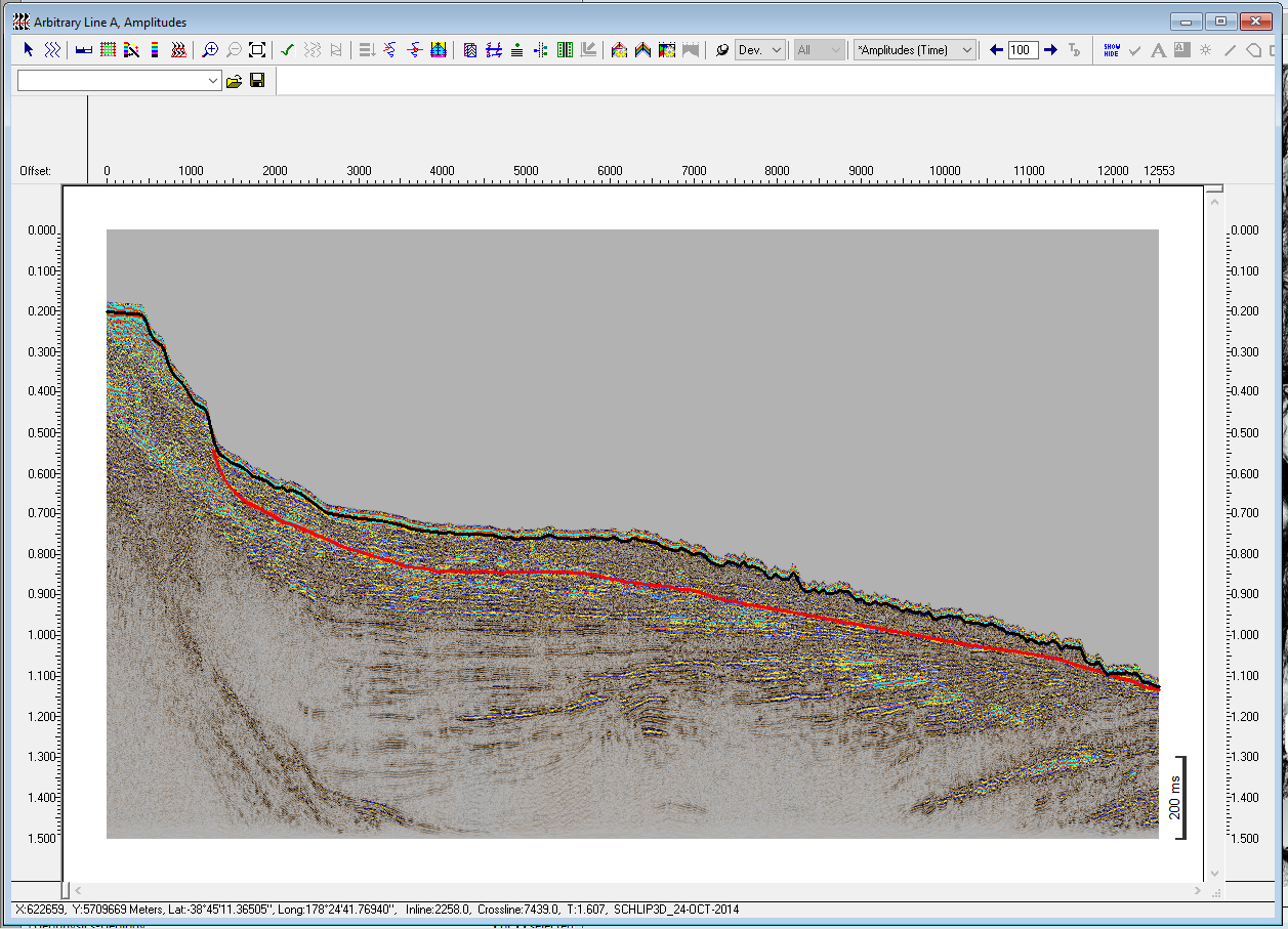
I am a doctoral student within the project SLATE and am based at Christian-Albrechts-University in Kiel, Germany. My research is primarily centred on the quantitative description and analysis of submarine landslides using geophysical and hydroacoustic data. Compared to their terrestrial counterparts, submarine landslides are poorly studied; this is a direct consequence of lower (and more variable) data resolution compared to terrestrial data, and artefacts related to the overlying water column. These factors make quantitative analysis of submarine landslides challenging, and so the majority of studies rely on a qualitative approach. This makes comparison of landslides that are of differing sizes, in different settings or formed by different processes challenging as there is an inherent subjectivity involved in a qualitative approach. Studies have recognized the need for a unifying quantitative framework for the analysis of submarine landslides, with one recent study (Clare et al., 2018) laying out quantitative parameters that should be calculated for submarine landslides. However, if the extent of the landslide is visually delineated, calculation of these quantitative parameters remains non-unique. One goal of my project is to create a routine (using python or GIS software) for the semi-automatic delineation of submarine landslides. This will enable the calculation of a suite of geomorphic parameters (such as displaced volume, runout length, and width) in an objective manner, allowing for easy comparison of landslides of different ages and in varying settings.
Geomorphometric parameters such as slope gradient, profile curvature, aspect and surface roughness are routinely used to describe landforms both onshore and in the marine realm; however the suite of geomorphometric parameters that is used in a marine setting is greatly reduced compared to that utilised onshore. This is a consequence of data resolution and availability, as well as a distinct variation in the geomorphology of the seafloor compared to terrestrial landscapes. A second objective of my research is to explore whether there are additional geomorphometric parameters that are applied in terrestrial settings that could help to provide more information about submarine landslides.
Aaron Micallef is a lecturer at the University of Malta and leads their Marine Geology and Seafloor Surveying group. His research on the Storegga Slide offshore of Norway (e.g. Micallef et al., 2007; 2008) has contributed significantly to the application of geomorphometric parameters for the quantitative description of submarine landslides. The focus of my research stay was to learn from Aaron and to better understand where the gaps in knowledge in the field of quantitative parameterisation of submarine landslides lie. During the two weeks I spent in Malta, we worked on setting up a framework for the duration of my project: considering what questions we hope to answer and how my research can fit in with and complement other, on-going research. We also considered and began work on the task of semi-automatic delineation of submarine landslides. The two weeks in Malta were incredibly useful for refining the direction of my research and I look forward to ongoing collaborations with Aaron.
References
Clare et al. (2018). A consistent global approach for the morphometric characterization of subaqueous landslides. Geological Society of London, Special Publications, 477, doi: 10.1144/SP477.15
Micallef, A., Berndt, C., Masson, D. G., & Stow, D. A. V. (2007). A technique for the morphological characterization of submarine landscapes as exemplified by debris flows of the Storegga Slide. J. Geophys. Res., 112, 1-15, doi: 10.1029/2006JF000505
Micallef, A., Berndt, C., Masson, D. G., & Stow, D. A. V. (2008). Scale invariant characteristics of the Storegga Slide and implications for large-scale submarine mass movements. Marine Geology, 247, 46-60, doi: 10.1016/j.margeo.2007.08.003
- 17-27/01/2018