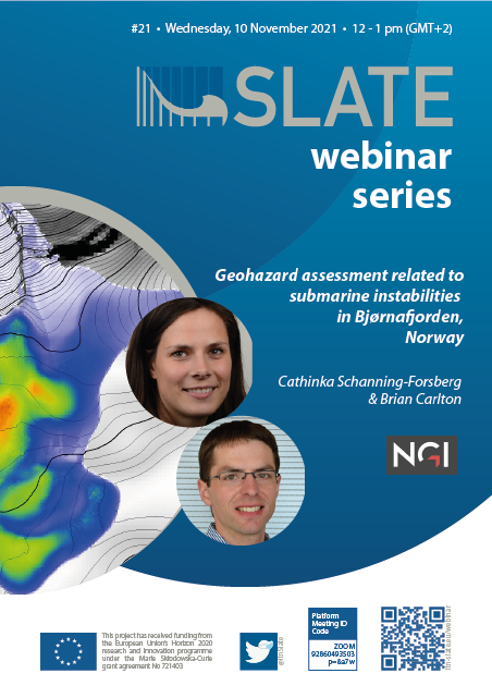
Geohazard
assessment related to submarine instabilities in Bjørnafjorden, Norway
SLATE webinar series #21, 10 November 2021
Cathinka Schanning-Forsberg
NGI Oslo, Norway
Brian Carlton
NGI Oslo, Norway
This presentation will discuss the geohazard assessment for a proposed bridge across Bjørnafjorden, in western Norway. The fjord is approximately 5 km wide with a maximum depth of 550 m at the proposed bridge crossing. The main geohazards of concern are submarine slope instabilities. To identify locations of instability, their susceptibility to failure, and their potential runout distances, we performed the following analyses: (1) static and pseudo-static limit equilibrium analyses for the entire fjord crossing area; (2) 1D seismic slope stability sensitivity analyses for different slope angles and soil depths; (3) 2D static and pseudo-static finite element analyses for selected profiles; (4) back-analysis of a palaeolandslide; and (5) quasi-2D and quasi-3D landslide dynamic simulations calibrated using results from the back-analysis. The workflow progresses from simplified to more advanced analyses focusing on the most critical locations. The results show that the soils in many locations of the fjord are potentially unstable and could be the loci of landslides and debris flows. The evidence of numerous palaeosubmarine landslides identified on geophysical records reinforces this conclusion. However, the landslide triggers and timing are currently unknown. The presentation demonstrates the need for comprehensive and multidisciplinary geohazard analyses for infrastructure projects conducted in fjords.