Expedition to Brute Inlet and Knight Inlet
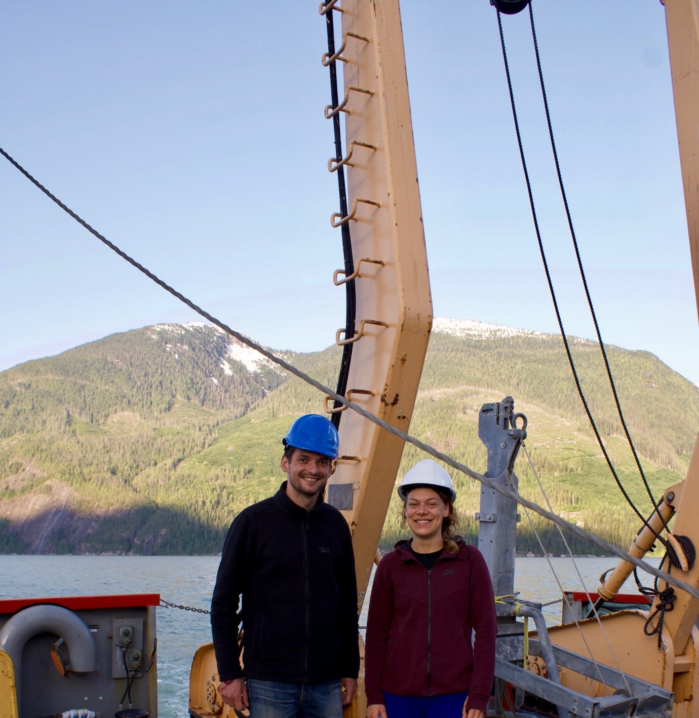
Kate Heerema (ESR 5), Maarten Heijnen (ESR 10) | @ British Columbia, Canada (May 2018)
10 days, 2 research vessels, 3 countries, 7 institutes and universities, 18 scientists, and 18 crewmembers helping out the crazy scientists. We – Maarten [ESR10] and Kate [ESR5] – were fortunate enough to be part of this major coordination effort to go out and explore what happens below sea level in two fjords in British Columbia, Canada, this May.
We will be using data acquired during this research expedition and the next expedition in November to study submarine mass flows that can occur as a result of submarine landslides. Landslides can cause long run-out flows of suspended sediment, which are capable of flowing hundreds of kilometres downstream of the slide. These flows are called turbidity currents and are often visualized as submarine sand avalanches that create and flow through submarine channels. These flows and associated channels are notoriously difficult to monitor due to their destructive nature and inaccessible environment. Many fundamental questions regarding these systems are therefore still unanswered, such as: How do turbidity currents exactly transport sediment? What does their velocity and density structure look like? How are submarine channels formed and how do they evolve?
Bute Inlet in British Columbia has proven to be an excellent test site for trying out new instruments and earlier expeditions have, over the years, accumulated a great amount of data. This allows us to use the Canadian fjords as an analogue for the impacts of these flows on European margins, in particular the Norwegian fjord systems. This cruise will be the last in a series of efforts to map the submarine channel in Bute Inlet and the flows that pass through this channel. We also visited Knight Inlet, a fjord just further up north from Bute which has relatively little data on it.
Cruising away
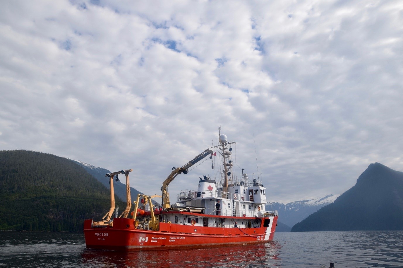
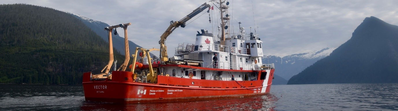
During this cruise we were on board the Vector, a vessel from the Canadian Coast Guard. During the 10 days we measured the surface of the seafloor using a multibeam device, acquired information of the subsurface using a 3,5kHz CHIRP sub bottom profiler, deployed moorings with multiple instruments to measure turbidity currents, and took sediment samples from box cores, gravity cores and grab samples. Before we boarded the Vector there were 2 days of mobilisation. Finding equipment, assembling instruments, measuring and insuring all is on board that is necessary (including a last-minute sprint for some key instruments). It was the first time for both of us on a research cruise, so living on a ship for 10 days was a new experience. For the Vector, all scientists were allocated either dayshift or nightshift, which were respectively 7AM to 7PM and 7PM to 7AM. All scientist shared cabins, when possible, with someone in the other shift, to create some privacy.
Dayshift
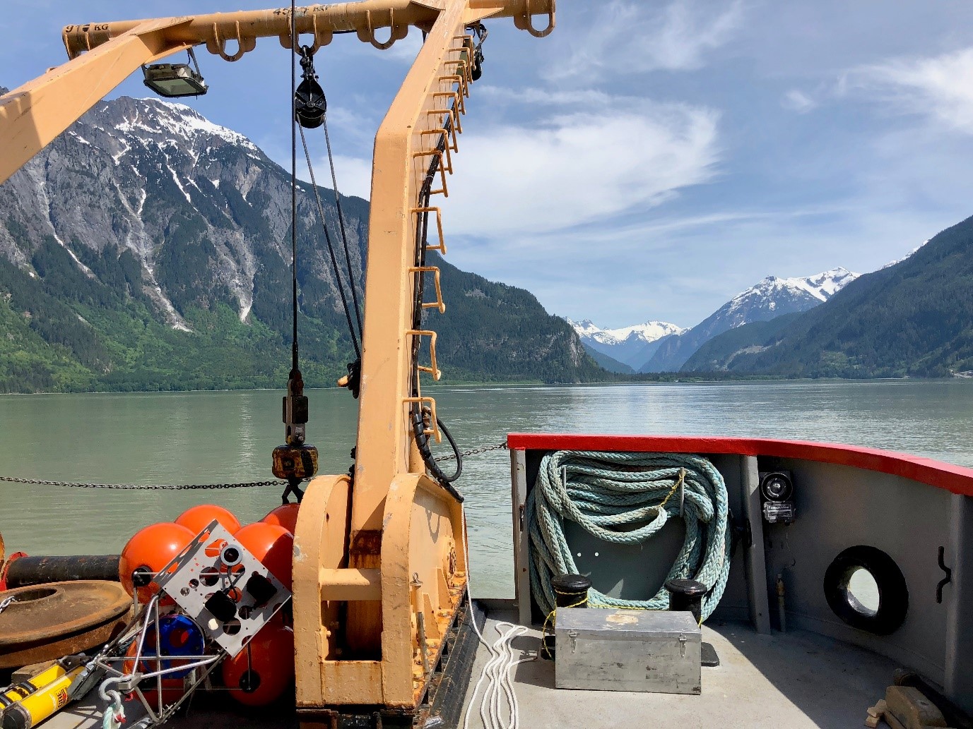
During the dayshift the moorings were assembled and deployed. The moorings we deployed consisted of 2 train wheels as anchor, an acoustic release, a buoy and of course the ADCP itself. Deploying the moorings was a smooth operation, and they were dropped within metres of the original planned location. For Kate, the deployment of moorings was key during this cruise. Multiple moorings were deployed along the channel, which all have an ADCP (acoustic Doppler current profiler) attached to it. The ADCPs register velocity and backscatter of the water column, so if a turbidity current passes, it will be registered. In 6 months’ time we will retrieve the moorings, and hopefully turbidity currents will have been recorded. Using this data, we can reconstruct a flow structure at each mooring, but also look at how flows develop with distance along the channel.
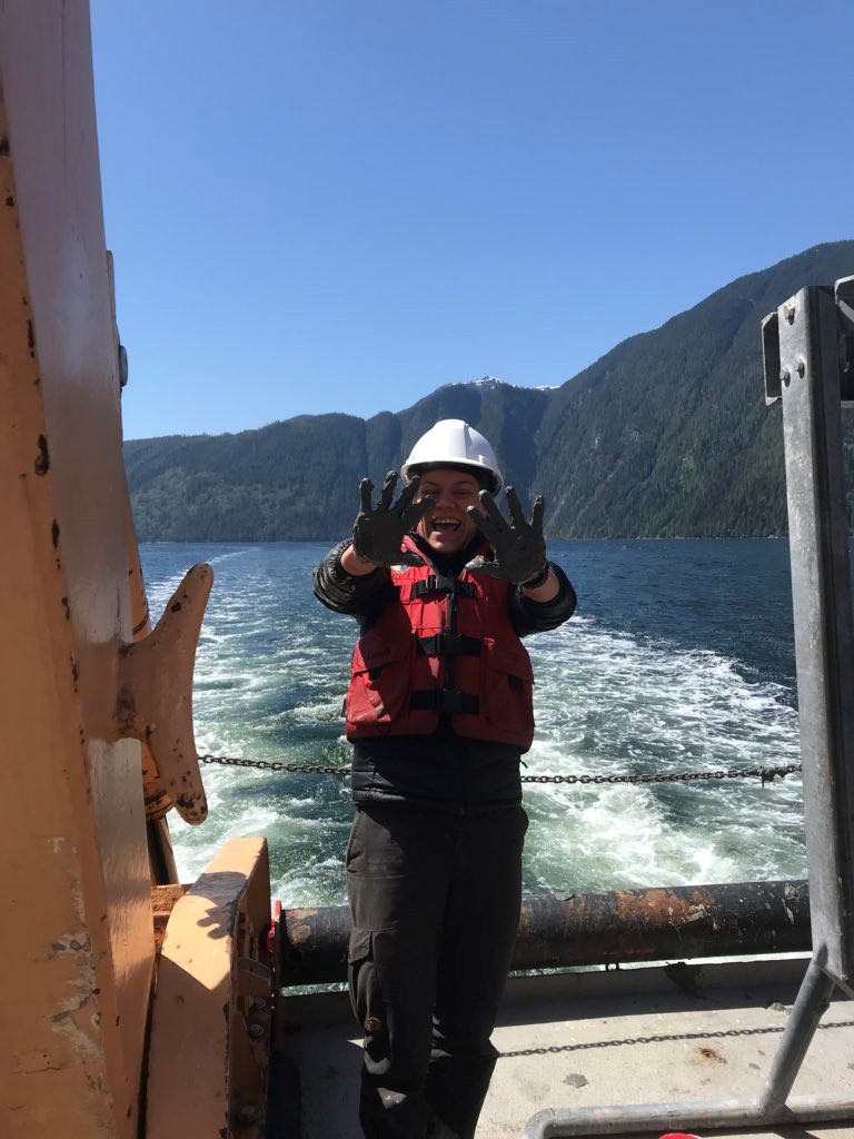
After deploying the ADCPs, several grab samples were taken. Grab samples are just as they sound – grabbing samples from the seafloor. On board we subsampled these for later analysis on clay mineralogy, EPS (the material responsible for the structure of biofilms) and organic carbon. Gravity cores are, again, just as they sound. A core with multiple weights is lowered to the seafloor and under gravity digs itself into the seafloor. The core is stored and is spliced and analysed later. Box coring is probably the fiddliest approach – where a box ~50x20x30cm is lowered into the seafloor. After a lot of attempts, the box is dismantled, and gives a great 2D view of the seafloor, revealing more structures compared to other coring techniques. Undisturbed sediments in the centre of the box core allow for subsampling for Pb-210 dating for example.
Niskin bottles were used to get water samples at several depths in the water column. These water samples are later analysed for sediment concentrations. For each sample the location was noted, as well as metadata such as the ships heading and speed.
Nightshift
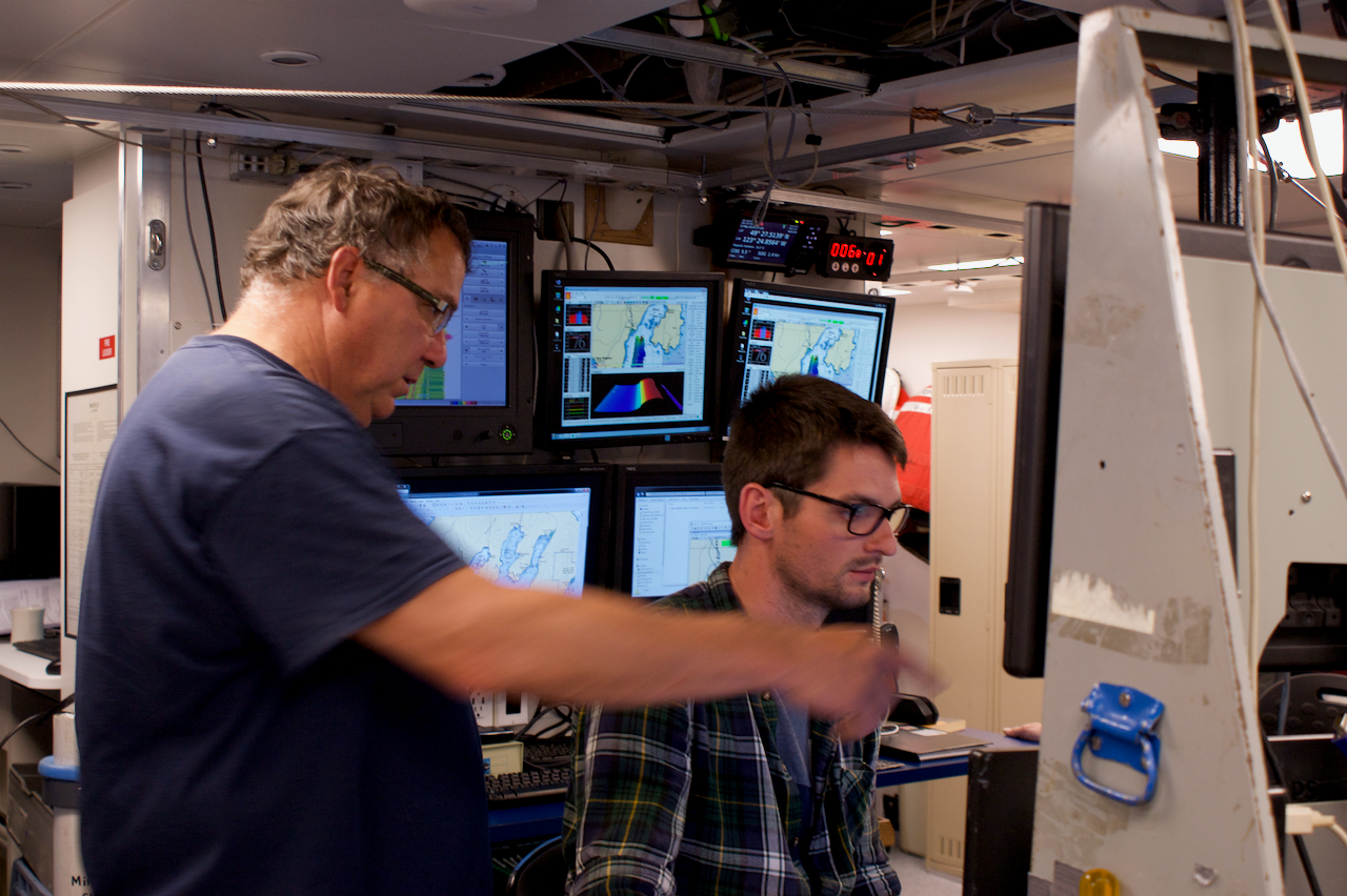
Dinner has finished, beers are opened, and jokes are made. That is when nightshift starts. Six out of the eight scientists on board were on dayshift. Me (Maarten) and one Canadian scientist were on nightshift. The main objectives of the nightshifts was to collect bathymetry data using the multibeam and collecting sub bottom data using the CHIRP. Maarten is using the bathymetry (measurements of the sea floor topography) from this year and data acquired almost yearly from 2008 onwards to finish a 10 year time-lapse evolution dataset of Bute Channel to study how submarine channels evolve. This data is obtained with a 70-100 kHz multibeam echosounder. This instrument sends high frequency beams towards the seafloor, which will reflect back from the sea floor and measured by a receiver. The travel time of these beams give an indication of how deep the sea floor is. This works, to some extent, the same as the echolocation used by bats. He will also be using the sub bottom data from the 3.5kHz CHIRP, which sends one beam of lower frequency to the sea floor, which is able to penetrate up to 50 metres into the seafloor, to image older buried sediment layers. Once turned on and calibrated, both instruments ran continuously without much manual operations. Only some adjustments had to be made when the water depth, or the material on the sea floor changed. Both instruments are attached to the bottom of the vessel and data is acquired by sailing over the areas of interest.
We were also responsible for planning how to cover to all areas of interest in the limited time and to set out routes for the captain of the ship to follow to make sure this data was acquired. The night shifts on this cruise were not the most diverse, but it was very nice to see the new data coming in live and comparing it with the previous survey and immediately see what has changed.
Life on the ship
The 8 scientists and 14 crew members had each their specific tasks, this included cooking and maintain the ship. Breakfast, lunch and dinner were served every day by the cook and steward, and meals to be put away for the staff on nightshift were also provided. Life will be difficult at home – having to cook for yourself, rather than having 3 options on the menu.
Besides all the hard work and long hours, there was some time for relaxing every now and then as well. Sitting on the back deck with a beautiful sunset and watching dolphins play in the swell created by the shift with the beautiful mountains bordering the fjords are beautiful moments shared with lovely people that we will never forget.
We are looking forward to the follow-up expedition in November, fingers crossed for mooring retrieval!