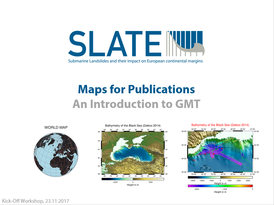
Generic Mapping Tools (GMT) are a freely available package containing numerous command-line programmes useful for generating a wide range of figures. As the name suggests, the tools are particularly well adapted to creating maps or other geo-referenced plots and come with a comprehensive collection of free GIS data, such as coast lines, rivers, political boundaries and coordinates of other geographic objects.
The course gives a general introduction into the tools application and focusses on a workflow for the production of simple and advanced maps (e.g. for publications, proposals, talks, cruise reports). Topics covered are:
Introduction to GMT modules
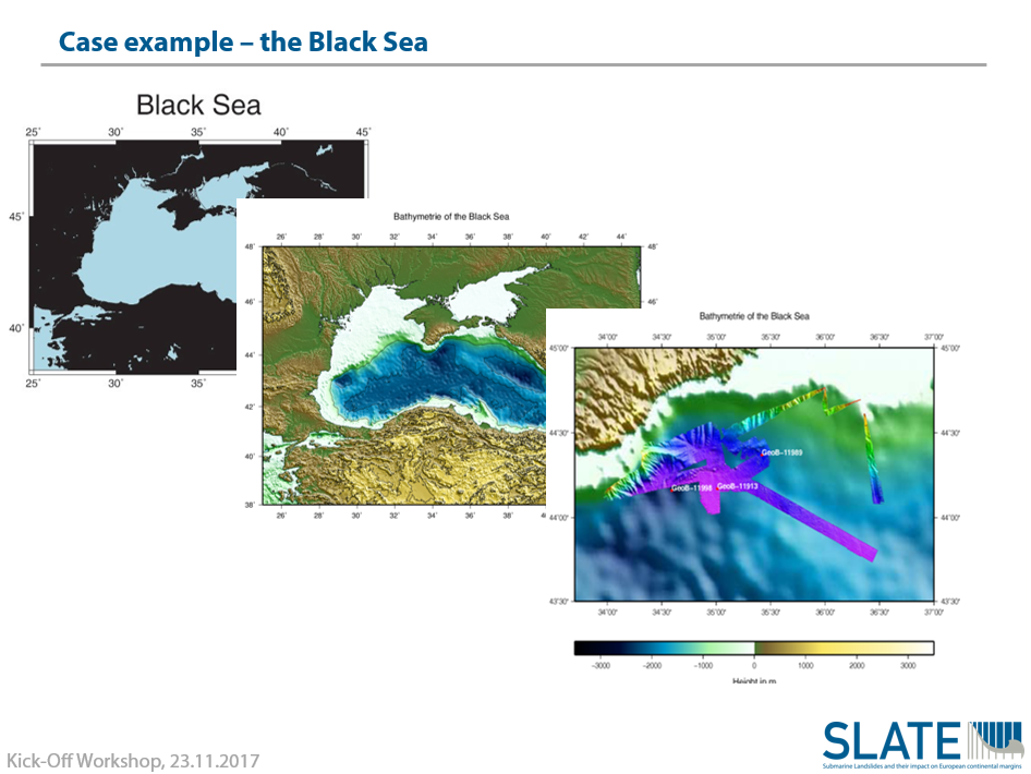
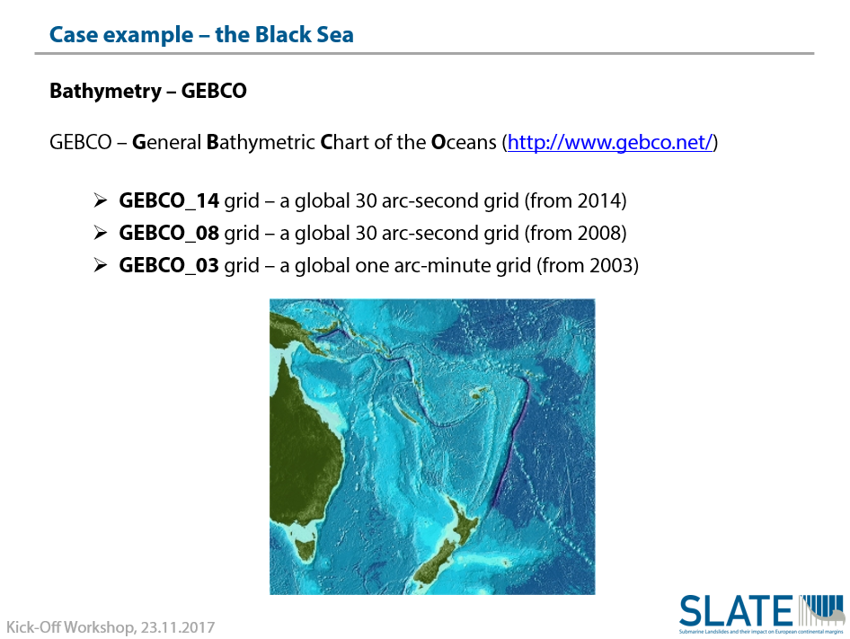
Implementation of freely available bathymetric data (GEBCO)
Plotting of first simple maps and exporting into PostScript (PS) format for further editing
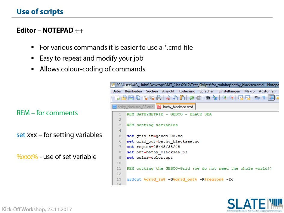
Utilization of scripts (Notepad++) for projects involving several lines of code
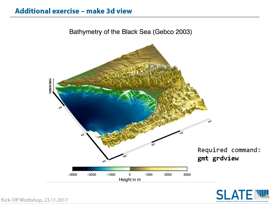
Creating and plotting gridded data and 3D plotting