Return to Southampton: My second stay at the National Oceanographic Centre Southampton (NOCS) and the University of Southampton

Ricarda Gatter, ESR 9 | May 2018

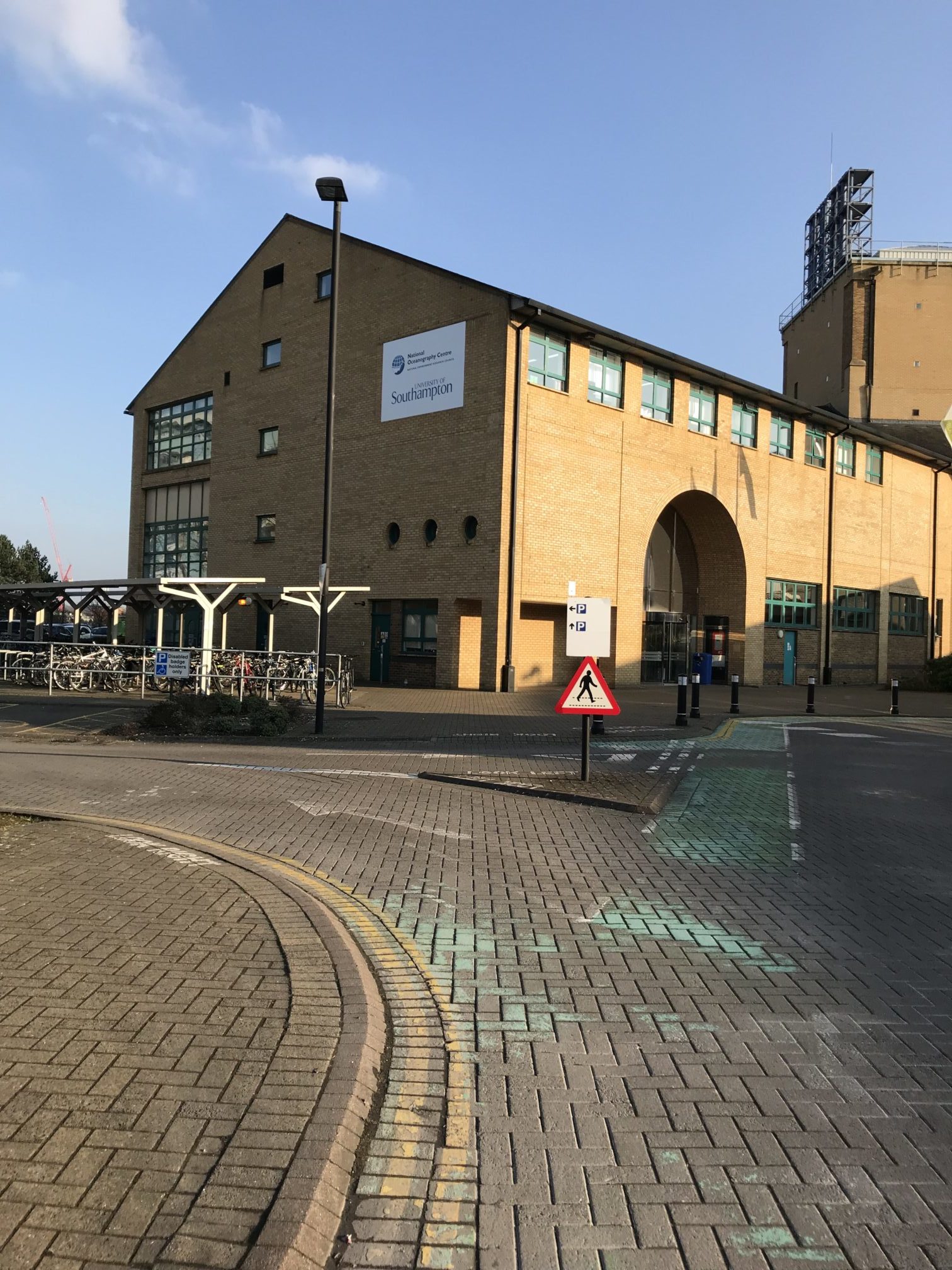
Southampton, known as the cruise capital of Europe, is a major port in South East England, just over an hour away from London. The University of Southampton has a global reputation for its research in oceanography, engineering and Earth science, and is home to the National Oceanographic Centre Southampton (NOCS). NOCS is a world-leading centre for research, teaching and technology development in ocean and Earth science.

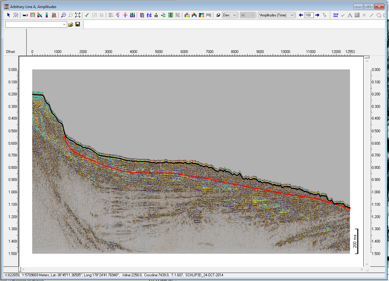
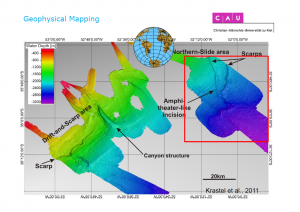
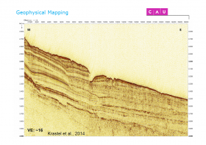
After my first stay in February (Report), I returned to Southampton in May to continue my work on µCT (micro-Computed Tomography) data. In particular, I focused on the data from the AFEN Slide (UK) and the Finneidfjord Slide (Norway). These two examples are of interest, because the available cores penetrated the failure planes of the slides, which are the focus of my PhD project.

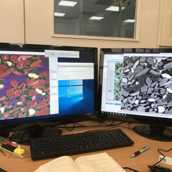
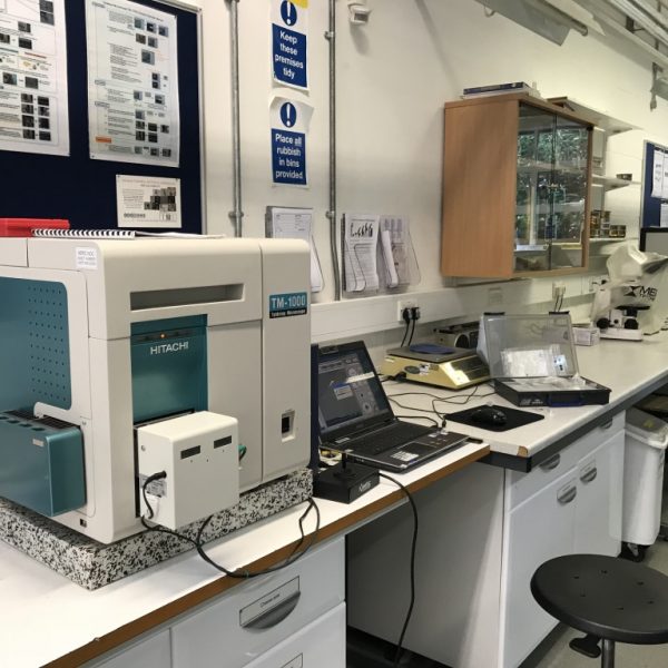
High-resolution µCT can be applied for the three-dimensional characterisation of individual particles in a sediment. The analysis of this data is accomplished by a series of steps, which include image pre-processing and filtering, image segmentation of particles, and subsequent textural and compositional analysis. At the µ-VIS X-Ray Imaging Centre at the University of Southampton, I was shown how to use the programs Fiji and Avizo 3D for image segmentation and 3D particle extraction.

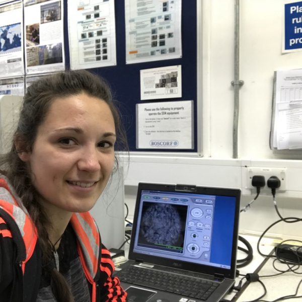
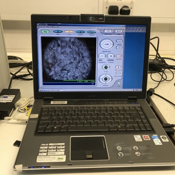
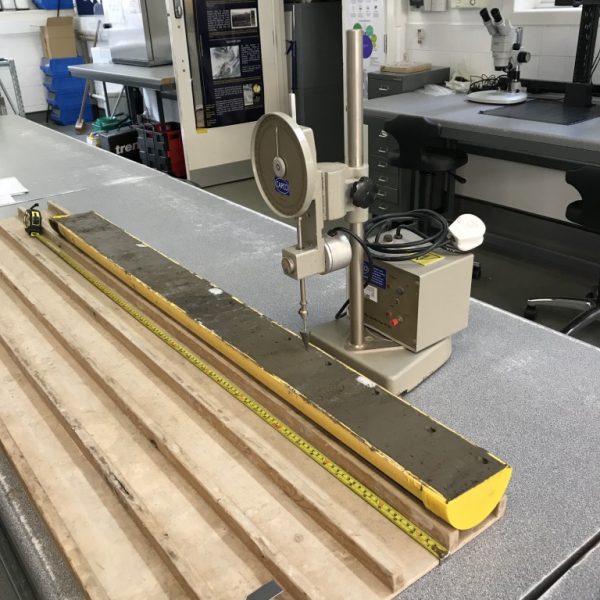
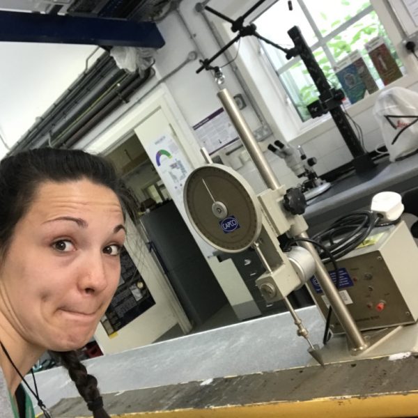
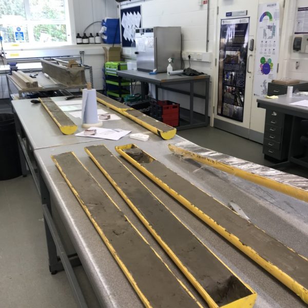
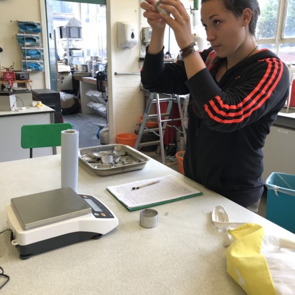
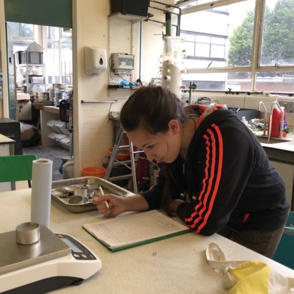
In addition, I gathered sedimentological and geotechnical data from the AFEN cores at the British Ocean Sediment Core Research Facility (BOSCORF). BOSCORF is the UK national deep sea core repository, set up by the Natural Environment Research Council (NERC). There, I was introduced to the BOSCORF stuff, Vicki Taylor, Mike Edwards and Miros Charidemou. All three of them gave me great assistance during my stay, preparing the cores and guiding me when using BOSCORF equipment. I am extremely grateful for all their help and support.

During my stay, I also had the chance to meet Dr. Mark Vardy (SAND geophysics), who has done a lot of work on the Finneidfjord Slide. He gave me more information on the slide and about the research that has been done so far. The discussion we had was very helpful to resolve how my research could fill the gaps in the current work.

I would also like to thank Dr. James Hunt (NOCS) for his guidance regarding the AFEN slide, and Dr. Madhusudhan B.N. Murthy for supervising me during my stay in Southampton and helping me with the geotechnical data acquisition at BOSCORF and the Geotechnics Lab at the University of Southampton.

Apart from my work, I also had the opportunity to participate in a range of social events, such as the Common People Festival and the Southampton park run. Moreover, I met amazing people, who made my stay even more enjoyable and I am already looking forward to see them again!

Tugdual's research stay with Eni

Tugdual Gauchery (ESR3) | @ ENI, Milan, Italy (21-25 May 2018)

After my participation to the conference in Victoria (British Columbia), I had the chance to accompany my supervisor (Marzia Rovere) and 3 people from ISMAR to the Eni laboratories in Milan. As they are involved in the SPOT Project (Potentially Triggerable Offshore Seismicity and Tsunamis, ABSTRACT), they had a special authorization to access the data room for a limited time (2 weeks). My supervisor made the demand if I also could have the access to some of the data for my PhD.

Eni is an energy company, one of the global oil and gas super-players employing 33,000 people and operating in oil and gas exploration, production, refining and selling. This one-week visit was a great opportunity to visualize 2D Multi-Channel Seismic profiles they collected in the east of the Gela Basin. One of my main observations is that the pre-existing topography controlled the extension of the MTDs (Mass Transport Deposits).  Moreover, I was able to define a few geological ages along the slope by picking horizons on seismic lines where drilling well profiles are located. In fact, drilling wells were recovered on the Malta Plateau and some of the core logs are accessible online (ViDEPI). Thanks to this, I extended the horizons picked (representing different geological time moments) towards my study area. This was not an easy exercise because many crossing lines have to be picked before reaching the study area and the picking is not always obvious from one line to another. This is why it makes it easier to choose drilling wells (which also have the data available online) close to the study area to reduce the risk of misinterpreting. 

I would like to say thank you to my supervisor for asking an access to the data room and her precious advice, the Eni company for granting access to the data, and my colleagues from ISMAR for answering my questions and helping me with my work. 

Where?
  • ENI, Milan, Italy
When?
  • 21-25/05/2018

Ricarda Gatter’s secondment at the NOC and University of Southampton

Ricarda Gatter, ESR 9 | 19-23/02/2018

In my PhD project, I investigate factors that pre-condition submarine slopes to fail. I focus on the characterisation of the material near the basal failure planes of different slides and the material’s behaviour prior and during the initial stages of slope failure. The processes occurring prior and during failure are still poorly understood, as they cannot be directly observed or monitored, at least not on a grain-scaled level. However, this information is necessary to gain a deeper understanding of the failure mechanism and hence, the slide evolution itself.

In order to investigate the failure processes at the initial stage of submarine landslides, I will conduct 3D numerical shear experiments. These experiments will be combined with a comprehensive dataset of micro-Computed Tomography (µCT) images and sedimentological analyses of selected cores from different submarine landslides. From this dataset, information about sediment composition and texture, as well as porosity and permeability estimations, in the vicinity of the basal shear planes will be gathered. This information will directly act as data input for the numerical simulations.

The µ-VIS X-Ray Imaging Centre at the University of Southampton, a centre for Computed Tomography (CT), provides complete support for 3D imaging science. The centre encompasses seven complementary scanning systems, which support spatial resolutions down to approximately 200 nm. This high resolution enables the visualisation and 3D reconstruction of single grains or clasts inside the sediment cores.

In February, I took off to Southampton to work with my second supervisor Dr. Michael Clare from the National Oceanographic Centre, Southampton (NOCS). He introduced me to Dr. Madhusudhan B.N. Murthy from the University of Southampton, who has acquired a number of µCT scans from various cores, which I will use to set up my numerical model. My short 5-day stay served as an introduction to µCT, to screen the available data, and as a preparation for a longer stay in spring 2018.

Although my stay in Southampton was very short, I really enjoyed my time there. I was able to look through the available data and make new acquaintances at NOCS and the University of Southampton. I also got the chance to meet Maarten again, another PhD student in the SLATE project. It was great to hear about what he was working on and to meet some of the other PhD students he is working with at NOCS. I am looking forward to my second stay at Southampton and future successful collaborations with the University and NOCS.

Tugdual shares his experience of this year's EGU General Assembly

Tugdual Gauchery (ESR3) | @ Vienna, Austria (8-13 April 2018)

The European Geosciences Union (EGU) is the biggest meeting of geoscientists in Europe. During 1 week, more than 15,000 scientists gathered to exchange and to present their work in front of the worldwide scientific community. This conference was my first participation in a conference and was a great opportunity to present my work and get feedbacks.

The poster I presented entitled “Geomorphology of Multi-Stage Submarine Landslides along the South Eastern Slope of the Gela Basin in the Strait of Sicily (Central Mediterranean Sea)” was about the geomorphological analyses of the eastern Gela Basin where multiple submarine landslides were mapped (area, thickness…) as well as their source areas (head scars). The preliminary results, extracted from the visual interpretation of the bathymetrical maps and with the CHIRP profiles, show that there is a certain occurrence in landslides accumulating in the deepest part of the Gela Basin. Most of the recent slides cover a large area in the SE Gela Basin but are very thin (around 10 m) except for 2 slides: the South Father Slide (SFS) and the South Gela Basin Slide (SGBS). The SGBS will be presented at the European Seismological Commission (ESC) 36th General Assembly, which will be held in September in Malta, about its tsunamigenic potential estimated and the eventual consequences on the coasts of Sicily and Malta.

At the end, this conference allowed to meet many people with very diverse backgrounds, discuss a lot about my work giving rise to many ideas for the project and to see again many colleagues, old teachers, and friends.

Location
  • Vienna, Austria

Report on research secondment at the Marine Geology and Seafloor Surveying group of the University of Malta

Rachel Barrett, ESR 1 | 14-27/01/2018

I am a doctoral student within the project SLATE and am based at Christian-Albrechts-University in Kiel, Germany. My research is primarily centred on the quantitative description and analysis of submarine landslides using geophysical and hydroacoustic data. Compared to their terrestrial counterparts, submarine landslides are poorly studied; this is a direct consequence of lower (and more variable) data resolution compared to terrestrial data, and artefacts related to the overlying water column. These factors make quantitative analysis of submarine landslides challenging, and so the majority of studies rely on a qualitative approach. This makes comparison of landslides that are of differing sizes, in different settings or formed by different processes challenging as there is an inherent subjectivity involved in a qualitative approach. Studies have recognized the need for a unifying quantitative framework for the analysis of submarine landslides, with one recent study (Clare et al., 2018) laying out quantitative parameters that should be calculated for submarine landslides. However, if the extent of the landslide is visually delineated, calculation of these quantitative parameters remains non-unique. One goal of my project is to create a routine (using python or GIS software) for the semi-automatic delineation of submarine landslides. This will enable the calculation of a suite of geomorphic parameters (such as displaced volume, runout length, and width) in an objective manner, allowing for easy comparison of landslides of different ages and in varying settings.

Geomorphometric parameters such as slope gradient, profile curvature, aspect and surface roughness are routinely used to describe landforms both onshore and in the marine realm; however the suite of geomorphometric parameters that is used in a marine setting is greatly reduced compared to that utilised onshore. This is a consequence of data resolution and availability, as well as a distinct variation in the geomorphology of the seafloor compared to terrestrial landscapes. A second objective of my research is to explore whether there are additional geomorphometric parameters that are applied in terrestrial settings that could help to provide more information about submarine landslides.

Aaron Micallef is a lecturer at the University of Malta and leads their Marine Geology and Seafloor Surveying group. His research on the Storegga Slide offshore of Norway (e.g. Micallef et al., 2007; 2008) has contributed significantly to the application of geomorphometric parameters for the quantitative description of submarine landslides. The focus of my research stay was to learn from Aaron and to better understand where the gaps in knowledge in the field of quantitative parameterisation of submarine landslides lie. During the two weeks I spent in Malta, we worked on setting up a framework for the duration of my project: considering what questions we hope to answer and how my research can fit in with and complement other, on-going research. We also considered and began work on the task of semi-automatic delineation of submarine landslides. The two weeks in Malta were incredibly useful for refining the direction of my research and I look forward to ongoing collaborations with Aaron.

References

Clare et al. (2018). A consistent global approach for the morphometric characterization of subaqueous landslides. Geological Society of London, Special Publications, 477, doi: 10.1144/SP477.15

Micallef, A., Berndt, C., Masson, D. G., & Stow, D. A. V. (2007). A technique for the morphological characterization of submarine landscapes as exemplified by debris flows of the Storegga Slide. J. Geophys. Res., 112, 1-15, doi: 10.1029/2006JF000505

Micallef, A., Berndt, C., Masson, D. G., & Stow, D. A. V. (2008). Scale invariant characteristics of the Storegga Slide and implications for large-scale submarine mass movements. Marine Geology, 247, 46-60, doi: 10.1016/j.margeo.2007.08.003

Monika Wiebe’s secondment at Christian-Albrechts-Universität (CAU), Kiel, Germany

Monika Wiebe, ESR 11 | 15-26/01/2018

The European training network SLATE brings together young scientists that are focused on studying submarine landslides, which are underwater mass movements. We use different methods to dig deeper into the questions of why, how and when landslides happen. My preferred method is numerical modelling in which I use computer programs to rebuild an underwater slope. Then I run a number of tests to figure out what makes this slope unstable and eventually break. The goal of this approach is to draw conclusions for landslides in general.

At the moment, my focus is on one particular landslide – the Tuaheni landslide complex offshore of the North Island of New Zealand. This landslide is ideal for my purposes because it is probably the best studied landslide in recent years. This provides me with all the data I need to set up my model. My second supervisor Prof. Dr. Sebastian Krastel from CAU, Kiel, and his working group have acquired a 3D seismic cube that covers large parts of the Tuaheni landslide. Seismics allows us to look into the deeper parts of the subsurface; it reveals the existence and location of stratigraphic layers and other features, e.g. gas pockets or faults.

In January, I went to CAU in Kiel so that I could get familiar with this data set. I met with Dr. Felix Gross who is experienced in interpreting seismic data and knows the 3D cube very well. He helped me to understand what the seismic data tells me about the slope, e.g.  which are the different layers, and how to recognise faults and gas. This information is essential to set up my model in a realistic way.

I also had the chance to meet other colleagues and have valuable discussions with them: Dr. Gareth Cruchtley from GNS Science, New Zealand, and Christoph Böttner from Geomar, Kiel, have both been working on the Tuaheni landslide complex. They could give me more insight into their research and results, and ideas for my own project.

Overall I really enjoyed my stay in Kiel, although I did not get to see much of the city itself due to the short time (and the almost constant grey sky and fog). I felt very welcome in Sebastian Krastel’s working group and enjoyed meeting the other colleagues there and having lunch together. Not to mention that the cafeteria has some of the best coffee I’ve ever tasted!

I went back to Bremen with a hard drive of seismic data and a much clearer picture of the Tuaheni landslide in my mind. This will enable me to take the next step and set up the model geometry. I am very grateful to Sebastian Krastel for inviting me and especially to Felix Gross for all the help with the 3D cube.

Saint Barbara at UniLaSalle Beauvais, France

Outreach activity by Tugdual Gauchery (ESR3) | 02/12/2017

Saint Barbara or simply “Barbara Day”, also known as “Barbarafest”, is the patron saint of armourers, miners, and generally of people who work with explosives and/or in the mountains including – by extension – the geologists/volocanologist /geophysicists.

For this occasion, every year, the department of geology of “UniLaSalle Beauvais” organises an information day for the students and their parents on the world of Geosciences. To do so, graduated students (Alumni) are invited to the university to present their work and open, to the students, new horizons thanks to the round tables. It is a unique moment in the year for the students to debrief their career orientation. It is also a moment for graduated students to meet again, exchange and maybe create future collaboration.

Another point is that the university is among a system called “LaSalliens” which is worldwide community and has for principle value the spirit of community. The values are well impregnated during the studies and explain why so many graduated students, every year, want to come back to the university and exchange with the students.

As part of this community, it is for all these reasons I wanted to go back (if I got the opportunity) and share my experiences with the new students as others did it with me when I was an undergraduate. This year, I had the opportunity to be part of a round table to talk about research with other PhD students in front of students and their parents. We presented our work, gave our sentiment and it was a good experience for everyone. In fact, there were PhD students at different stages of their research, as well as Post-Docs, which gave a large experience panel for the students.

Location

Geophysical mapping of submarine landslides –
an introduction into bathymetric and seismic mapping

@ Marum, Bremen | 24-25/11/2017

Geophysical mapping techniques provide an essential tool for the discovery of natural energy resources (oil/gas), but are widely applied to scientific problems such as climate research and hazard/risk analysis as well. Acquired datasets proof especially valuable in the recognition of submarine landslides and provide fundamental help in the interpretation of their mechanisms.

The course gives a general introduction into standard mapping techniques and provides examples for their practical application at sea. Type datasets from various locations are used as examples for interpretative analyses followed by a practical excercise. Topics covered are:

  • Bathymetric mapping
  • Sidescan sonar
  • Seismic imaging
  • Examples / Practical exercise using Fledermaus
Course type
  • Expert course
Downloads
  • [log-in required]

Maps for publications – an introdcution to GMT

@ Marum, Bremen | 23/11/2017

Generic Mapping Tools (GMT) are a freely available package containing numerous command-line programmes useful for generating a wide range of figures. As the name suggests, the tools are particularly well adapted to creating maps or other geo-referenced plots and come with a comprehensive collection of free GIS data, such as coast lines, rivers, political boundaries and coordinates of other geographic objects.

The course gives a general introduction into the tools application and focusses on a workflow for the production of simple and advanced maps (e.g. for publications, proposals, talks, cruise reports). Topics covered are:

  • Introduction to GMT modules
  • Implementation of freely available bathymetric data (GEBCO)
  • Plotting of first simple maps and exporting into PostScript (PS) format for further editing
  • Utilization of scripts (Notepad++) for projects involving several lines of code
  • Creating and plotting gridded data and 3D plotting
Course type
  • Expert course
Lecturer
  • Jannis Kuhlmann (MARUM)
Downloads
  • [log-in required]
  • [log-in required]

1st annual slate workshop

@ Marum, Bremen | 20-25/11/2017

ESRs, PIs, associated partners and invited international experts came together in November 2018 for the 1st Annual SLATE Workshop, which took place at MARUM, University of Bremen, Germany. The kick-off workshop introduced and discussed research and training aims within the SLATE project, while providing the novice ESRs with a state-of-the-art review of submarine landslide research as well as technical workshops and expert courses to create a common working base. Further emphasis was put on the establishment of contacts between the partners and the development of strong research synergies that will continue throughout (and hopefully beyond) the life cycle of the SLATE project.

The workshop started with a warm welcome by the director of the MARUM (Michael Schulz) and an introductory talk by the project manager (Katrin Huhn) outlining the general SLATE structure and research aims. Three key-note lectures delivered the current state of research on submarine landslides along continental margins in terms of (I) pre-failure processes, (II) post-failure processes, and (III) associated hazards – all of which was picked up in the public lecture by Christian Berndt (GEOMAR, Kiel) on tsunamogenic ocean island collapse at Ritter Island.

During the workshop, ESR students presented and discussed their preliminary research ideas and held their first Personal Training and Career Development Committee (PDPC) meeting with their main and co-supervisors to plan secondments and major milestones for the upcoming months. Technical workshops focussed on geophysical mapping techniques and the visualization of data, while an expert course was designed to improve scientific writing skills.

To promote network coherence, we arranged for a social evening with a joint dinner and arranged a fieldtrip on the last workshop day to visit the Alfred Wegener Institute (AWI) as well as the Climate House in Bremerhaven.

Downloads
  • [log-in required]
Public lecture
  • Ritter Island – Tsunamis generated by volcanic ocean island collapse Christian Berndt (GEOMAR)
Key-note lectures
  • Understanding pre-conditioning factors, long-term trends in slope evolution & trigger mechanisms
    Roger Urgeles (CSIC)
  • Post-failure dynamics; transport mechanisms and dynamics incl. subsequent hazards, tsunamigenic potential
    Carl B. Harbitz (NGO)
  • Why landslide research? Impacts on offshore operations and management of European coastal areas – overview about recent activities
    Angelo Camerlenghi (OGS), Francesca Zolezzi (D’Appalonia)
Expert courses
  • Scientific writing
    Peter Talling (Uni Durham), Mike Clare (NOC)
Technical workshops