ESR 2
@ Sharing Geoscience Online (4-8 May) | 2020-05-18
SLATE goes EGU - Ready... set... TYPE!
ESR 2, ESR 4, ESR 5, ESR 6, ESR 9, ESR 10 | @ Sharing Geoscience Online (4-8 May 2020)
Everyone working in academic geoscience, especially in Europe, has the EGU week highlighted in their calendar. Even if not everyone has the luxury to travel to Vienna each year, we all have at least one colleague who is planning to present new work, new results, or new ideas at EGU. When the abstract submission deadline approaches we all feel involved, either directly or indirectly.
When we received the reminder about the upcoming deadline for session proposals in July 2019, it felt quite natural to try to organize a session to celebrate the last EGU of the SLATE project. No session focused specifically on submarine mass movements during EGU 2019, and the SLATE ESRs were scattered all over different sessions. For our last year, we wanted to organize something that could put all the SLATE ESRs and the submarine mass movements community together to present their work. We gathered five SLATE ESRs who were willing to contribute actively to the session’s organization, and with this motivation in mind, we started working on it.
First thing: you have to make sure that nobody else is organizing the same session. In our case, this meant getting in touch with the S4SLIDE community, which gathers many other researchers working on the topic of submarine mass movements. It took only one email to Lorena Moscardelli, the S4SLIDE chair, to get her full support for the initiative, including five travel grants for early career scientists to attend our session. We could not have had a better or more motivating start.
Everything from there on felt quite spontaneous: shape the session in a way that everyone working in the field could be involved, find a catchy session name, write the proposal, submit it. The session got accepted. We promoted it on our Twitter page (@itnSLATE ![]() ), making sure to be annoying enough that everyone working on submarine landslides knew about it. Eventually we received enough abstracts to have an oral and a poster session. Session time: late afternoon on Friday... Not ideal. Some hard negotiation with other conveners and the organizers later, the new session time: Monday afternoon. We could not have asked for a better outcome.
), making sure to be annoying enough that everyone working on submarine landslides knew about it. Eventually we received enough abstracts to have an oral and a poster session. Session time: late afternoon on Friday... Not ideal. Some hard negotiation with other conveners and the organizers later, the new session time: Monday afternoon. We could not have asked for a better outcome.
Then, the unexpected happened. Since everyone realized the COVID-19 pandemic was a serious threat, it was clear that it would somehow affect the conference week in Vienna. This bad feeling was confirmed by the end of March: “No EGU General Assembly in 2020, see you in 2021. BUT…we will try something different. This year, the EGU will be an online event, free and open to everyone”.
Honestly, the initial expectations were not so high, but as new details about the online conference were revealed, the enthusiasm started to increase. By mid April, it was clear that we were going to be pioneers of something that could represent a big innovation not only for EGU, but for the entire geoscience community: a virtual conference where thousands of people could talk about science. A drastic reduction in carbon emissions and no more worring about travel budgets. A potential opportunity to reach a larger number of scientists, and a chance to share our presentations beyond the geo-nerds who attend EGU in-person. In other words, there was potential for a scientific communication and outreach revolution.
We needed to make sure that the authors in our session were as motivated as we were. We got in touch with them and explained the importance of being part of such an exciting experiment. In the end, 12 out of the 20 original presenters uploaded their presentation materials ("displays"), and discussed their research on a live chat with more than 120 attendees. The level of engagement was unexpected: a two hour long active discussion, a multitude of specific and open questions, debates. Everyone could notice a considerably more dynamic environment than a regular oral session.
There is no doubt that this forced EGU online edition has been an eye-opener and a potential game-changer for future conferences. The benefits of such a format are obvious, as are the limitations and aspects which could be substantially improved given more organization time. The pros are an answer to years of discussion on how to make this conference more open, international and sustainable. In the last few years we have all seen a multitude of geoscientists travelling the whole continent by train, posting their adventures during their journey on social media. The 2020 edition showed that it is possible, and perhaps more realistic than previously thought, to attend the conference from home. Can you motivate people who are not geoscientists to travel to Vienna, pay for their participation, just to follow the few sessions which are understandable to a non-expert audience? Difficult. However, if you can access science in the comfort of your home, more ordinary people can and will tune in, and scientists will find a wider audience to discuss their discoveries with.
There were also limitations. The most obvious drawback is the lack of in-person interaction. As many of us experience during a regular EGU, there is no better networking than walking around posters, holding a beer and having informal conversations. As this is our natural way to act. Additionally, as everyone can attend from home, the time zones become more problematic and might exclude scientists from sessions they wish to attend. Finally, it requires stable internet access that not everyone has access to.
What if future editions allow authors to present through sharing screens online and explaining their research by talking, instead of writing? How about answering questions by voice, as we have seen in many Instagram or YouTube videos during this quarantine period? What if there was the possibility to create private chat or video-call rooms, where a private interaction between people is possible? Considering the huge online traffic of the online event, this was clearly not possible to set up in little more than a month. Nevertheless, does it sound so unrealistic to do in a one-year timeframe? Finally: is it sustainable to set up such a virtual event free of charge or at a very accessible cost?
There are many issues and challenge to address, but none of them seem impossible to overcome. The EGU Sharing Geoscience Online have shown an effective alternative to gather together thousands of scientists without making them travel, thanks to the creativity and the hard work of the organizers. It let us believe we saw the (much needed) future of conferences.
Is the future already here, or will we see each other in Vienna next year?
The EGU Session NH5.6 – Subaqueous mass movements: triggers, dynamics and hazards conveners.
 Jonathan Ford
ESR2
Jonathan Ford
ESR2
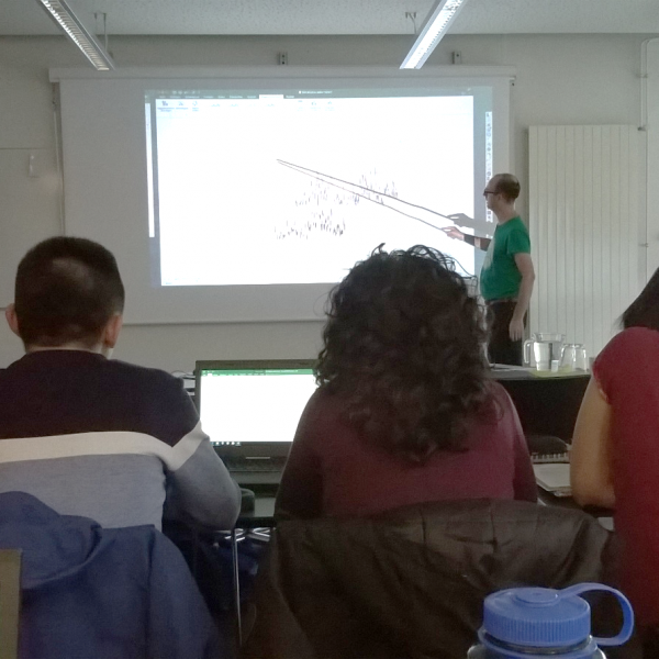
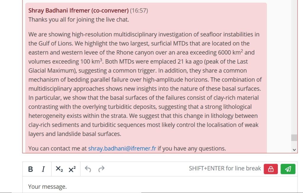
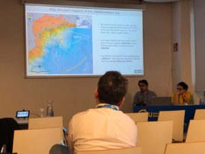
I presented an example of using seismic diffraction imaging to better image the internal structure of submarine landslide deposits. Several SLATE members were involved in the acquisition of this data during the INSIGHT (Legs 1 and 2) cruises, particularly PIs Roger Urgeles and Eulàlia Gràcia.
As I had no idea what to expect from the new online format, I simply uploaded the slides that I would have presented in Vienna. During the live-chat I introduced the presentation with a few sentences, the audience spent three minutes reading the slides and then five minutes of text-based discussion followed. The discussion was a little frantic - an oral presentation is nerve-wracking, but you never have to respond to several questions simultaneously! In hindsight I would have prepared fewer slides or an extended poster, similar to the existing PICO format at EGU. But I do think the informal chat allowed people to ask questions which they might not have asked during an oral presentation, and there was some good discussion and good points raised for all the presentations.
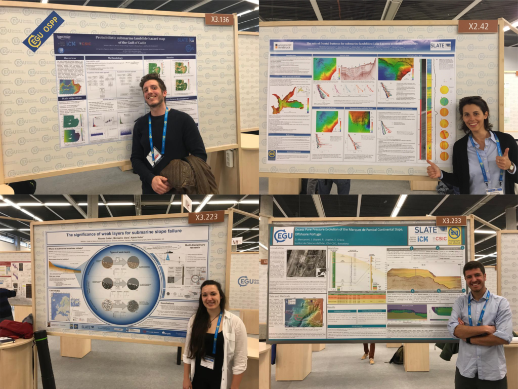
 Ricarda Gatter
ESR9
Ricarda Gatter
ESR9
“One of the most interesting and stressful experiences – and I was just reading the chat!”
I was not planning on joining the EGU General Assembly this year, as it was scheduled right in the middle of my secondment in Southampton. Well, plans change and I got the opportunity to follow this year’s conference after all. In particular, it allowed me to join the great session convened by Davide (ESR 6), Shray (ESR 4), Kate (ESR 5), Maarten (ESR 10) and William (ESR 12) - Subaqueous mass movements: triggers, dynamics and hazards. Looking back, I do not know if it was the best or most stressful experience ever 😀 It was amazing that we could chat – quite literally, in a chat portal – about ongoing science, ideas and controversies. I have to admit, however, following the ongoing discussion was also sometimes challenging – my highest respect to all the presenters and conveners! I think as a whole it was a great opportunity to be able to discuss science. Nevertheless, I am looking forward to the next conference – hopefully back in Vienna.
Location- Sharing Geoscience Online
- S. Badhani, ESR4
- K. Heerema, ESR5
- D. Mencaroni, ESR6
- M. Hejinen, ESR10
- W. Meservy, ESR12
- J. Ford, ESR2
- S. Badhani, ESR4
- D. Mencaroni, ESR6
- S. Collico, ESR8
@ Vienna, Austria (07 – 12 April 2019) | 2019-07-23
A GUIDE AROUND EGU 2019
ESR1, ESR 2, ESR 3, ESR 4, ESR 5, ESR 6, ESR 7, ESR 8, ESR 9, ESR 12, ESR 13, ESR 14, ESR15 | @ VIENNA, AUSTRIA (7-12 April 2019)
“The EGU General Assembly 2019 was a great success with 5,531 oral, 9,432 poster, and 1,287 PICO presentations that were attended by 16,273 scientists from 113 countries” (Copernicus Meetings, 2019).
SLATE was well represented with 12 PhD candidates, PIs (Achim Kopf, Michael Clare, Carl Harbitz, Finn Lovholt, Michael Strasser) and Aggeliki Georgiopoulou from the advisory board presenting their work.
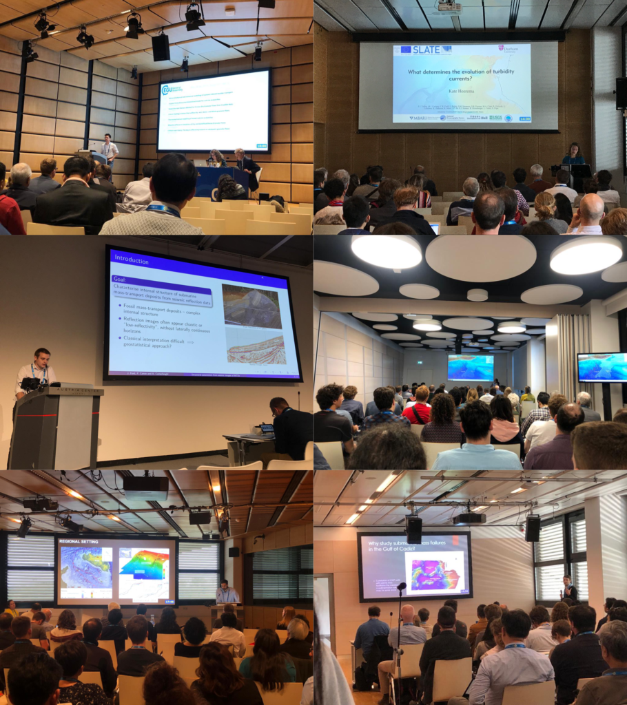
 Presenting our work
Rachel, Jonathan, Tugdual, Shray, Kate, William and Matthias drew crowds of people into the lecture rooms with their amazing presentations. They spoke on a variety of topics; covering different aspects of turbidites and their evolution, contourites and submarine landslides.
 “I was very happy to be able to present my work at this conference, as it gives an occasion to present our work in front of a wide audience with very diverse backgrounds. I came out with very good feedback and advice for my work.” (Tugdual Gauchery, ESR 3)
„It was my first time at the EGU and it was overwhelmingly large. I had the opportunity to talk to several researchers after my talk – it is always good to get feedback on both the positive and negative parts of ones research.” (Shray Badhani, ESR 4)
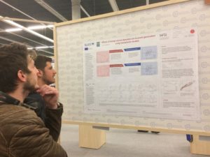
Davide, Ting-Wei, Stefano, Ricarda and Maddalena presented their work in the poster sessions and attracted a lot of people.
“Presenting a poster at a conference like EGU is a great learning opportunity for any early career scientist. On one hand, I had the chance to discuss my research with people working in the same research field and to meet scientists I had only known from reading their papers. What surprised me the most, however, were the questions I got from scientists specialized in completely different fields, looking at my project from a prospective I do not usually consider. People who were just randomly walking around posters asked me the most challenging questions, highlighting issues that I never considered before, but that helped me to have a more complete understanding of what I am studying.” (Davide Mencaroni, ESR 6)
And learning new thingsApart from presenting our own work, we took the opportunity to learn more about work from outside our own fields. Alongside the traditional poster and oral presentations, EGU also hosts so called “PICO” presentations (Presenting Interative COntent) and short courses on more general topics in science.
“One thing that I really enjoyed about EGU were the PICO sessions. PICOs start with quick-fire two minute presentations from each researcher to briefly introduce their topic and state their main conclusions. After, everyone moves across to the interactive area, where each presenter has their own workstation and large screen. This really facilitates discussion and allows for more flexibility that a standard poster or talk. For me, the PICO sessions are a great way to be introduced to an unfamiliar area, because the results are presented up front and you get to see a rapid cross section of the state-of-the-art in a particular field.” (Jonathan Ford, ESR 2)
“It was a great opportunity to get some insights from overlapping, but vastly different, fields. For instance to see what the current state of research in Powder Snow Avalanches is, or to get some background knowledge on numerical modelling in turbidity currents as preparation for my secondment at NGI.” (Kate Heerema, ESR 5)
“One of the most exciting sessions I attended was on the recent tsunami events in Sulawesi and West Java (Krakatao), Indonesia (Blog). Although most of the group seemed to agree that these tsunami events were, in fact, submarine landslide-related, there was some surprisingly lively pushback from at least one seasoned researcher. I think the overall tsunami community seems to be experiencing a small paradigm shift in how they think about tsunami hazards. I also enjoyed stopping by different poster sessions related to tsunami hazards and had some great networking conversations with a group of researchers from Singapore about their work and how it relates to some tsunami survey work that I previously did as a master’s student” (William Meservy, ESR 12)
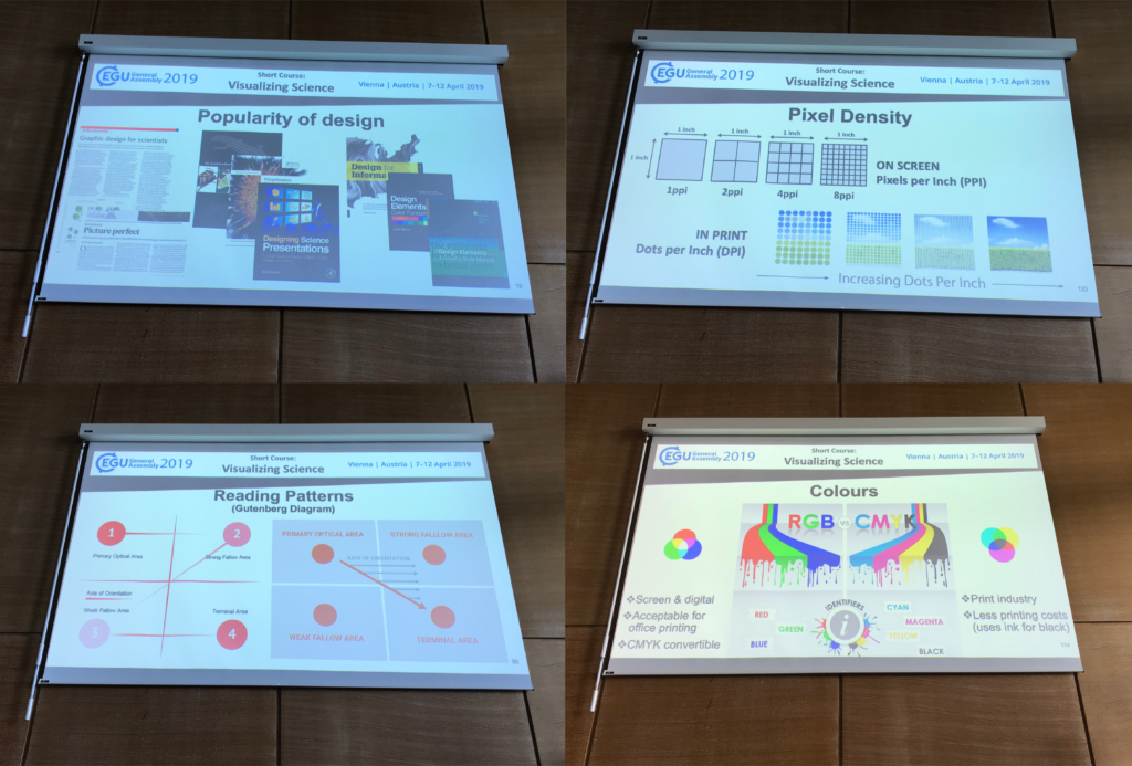
“I went to three courses, of which I especially liked the “Visualizing Science” course. I think we often forget how important it is to present our research to other scientists, as well as to the general public.” (Ricarda Gatter, ESR 9)
“The quantity and variety of soft skill courses available at the EGU undoubtedly adds value to the conference. I attended a course about communicating science with the general public and enjoyed hearing different perspectives about what effective communication looks like, and how that can take different forms. One point that stood out was the value of knowing when it is worthwhile to get the assistance of people who are trained in communication, such as journalists, to communicate significant results.” (Rachel Barrett, ESR 1)
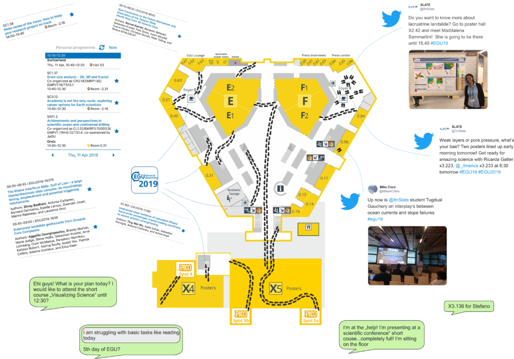
Need help to find your way around? - use the EGU AppFinding your way around a big conference such as EGU can be difficult. Luckily, there was an app available in which you could find all the contributions and put together your personal programme. In addition, we kept everybody up to date with our own contributions via Twitter.
“I knew that EGU is the most important Geoscience conference in Europe, but I didn’t expect something like this. It was difficult not to be impressed by the amount of different topics and talks, but above all, I was struck by the hundreds of posters that everyday are hanging in these huge rooms.” (Maddalena Sammartini, ESR 15)
To sum it up“I was honestly impressed by the EGU conference. It was the perfect environment to discuss a wide range of research topics and learn about other researchers’ PhD experiences.” (Stefano Collico, ESR 8)
“It is such a great international experience. I even met my friends from my home university in India. I am already looking forward to EGU2020.” (Shray Badhani, ESR 4)
“One of the highlights of the experience for me was that I was lucky enough to be able to bring my wife and kids along to explore Vienna. In the evenings, we were able to walk in the city together and eat a lot of goulash and Viennese chocolate cake” (William Meservy, ESR 12)
“EGU is an essential event for every geoscientist working Europe. It is the perfect opportunity to meet new people with common interests, present the latest progress of your work, get valuable feedback and to foster old friendships” (Matthias Rauter, ESR 14)
EGU - Let's meet again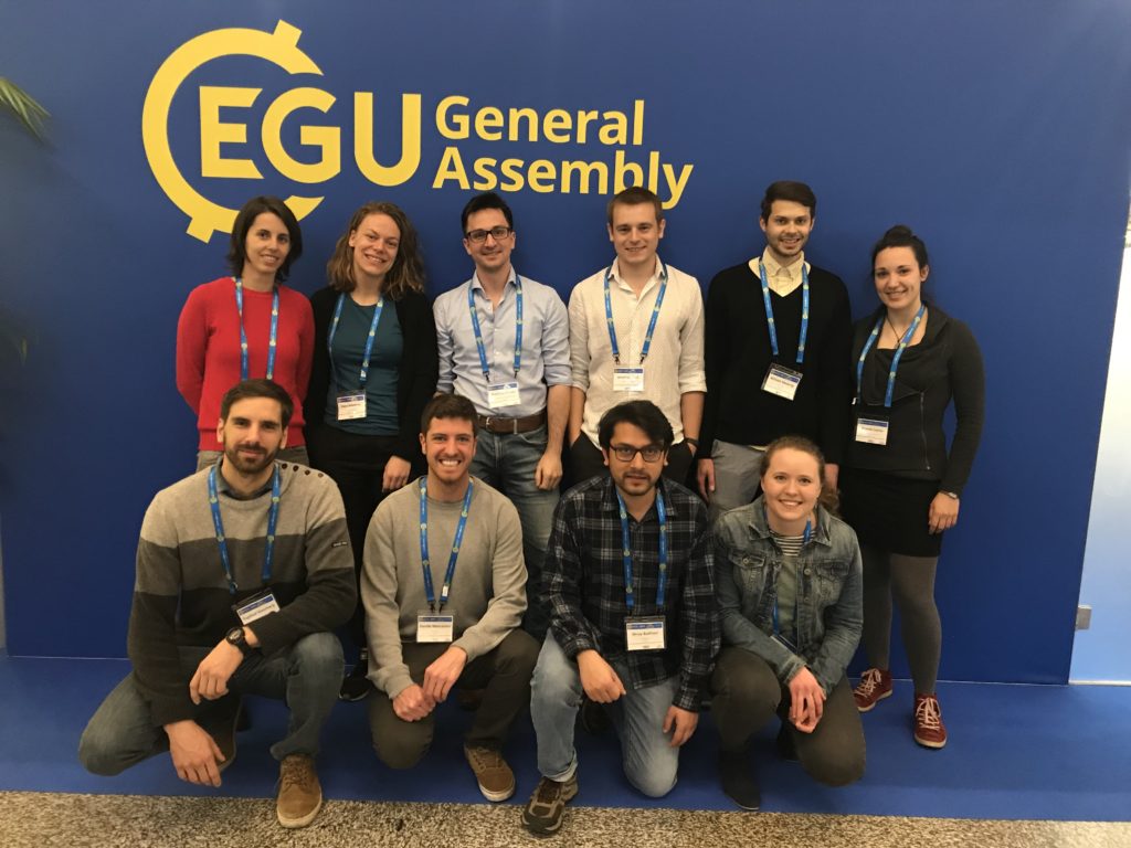 Location
- Vienna, Austria
 Conference Schedule
SLATE participants
ESRs:
Conference Schedule
SLATE participants
ESRs:
- R. Barrett, ESR1 [Talk]
- J. Ford, ESR2 [Talk]
- T. Gauchery, ESR3 [Talk]
- S. Badhani, ESR4 [Talk]
- K. Heerema, ESR5 [Talk]
- D. Mencaroni, ESR6 [Poster]
- T-W Wu, ESR7 [Poster]
- S. Collico, ESR8 [Poster]
- R. Gatter, ESR9 [Poster]
- W. Meservy [Talk]
- T. Zengaffinen, ESR13 [Poster]
- M. Rauter, ESR14 [Talk]
- M. Sammartini, ESR15 [Poster]
- A. Kopf, PI of ESR7 [Poster]
- M. Clare, PI of ESR10 [PICO]
- C. Harbitz, PI of ESR13
- F. Løvholt, PI of ESR14 [Poster]
- F. Løvholt, PI of ESR14 [Convener]
- M. Strasser, PI of ESR15
- A. Georgiopoulou, Advisory Board [Talk]
expert courses | 2018-10-16
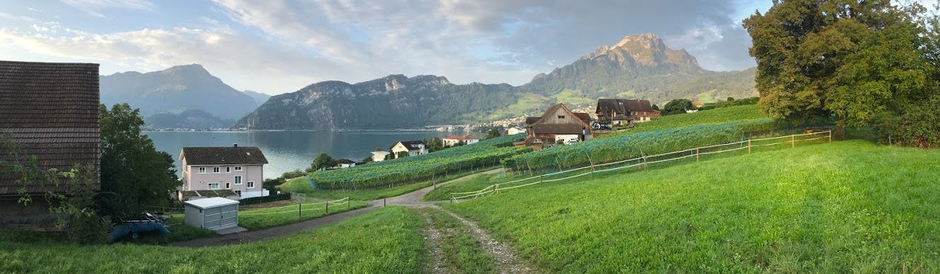
Lake Lucerne Workshop - Expert courses
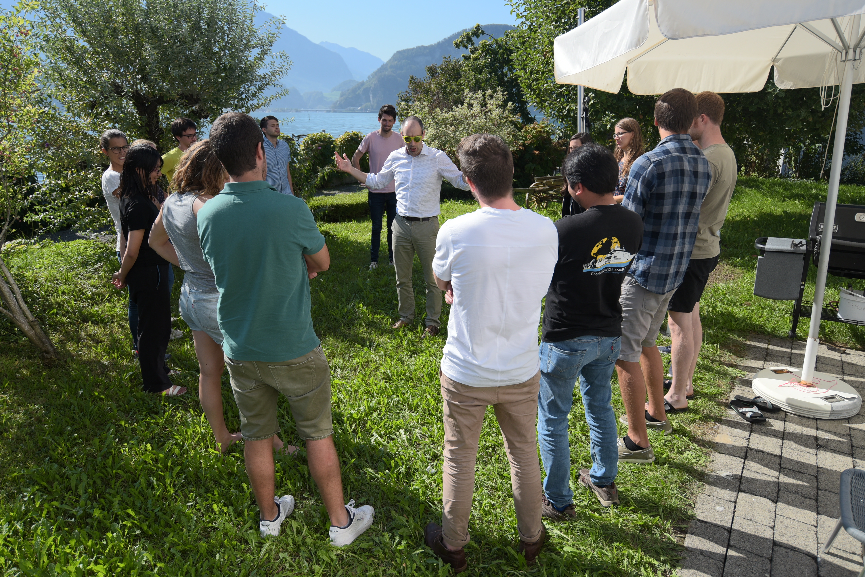
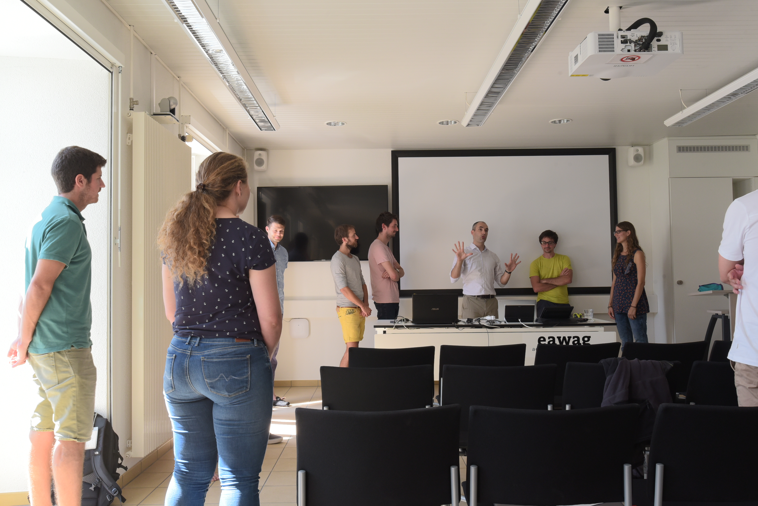
Jonathan Ford (ESR2), Monika Wiebe (ESR11), William Meservy (ESR12) | @ EAWAG Kastanienbaum, Switzerland (9-16 September 2018)
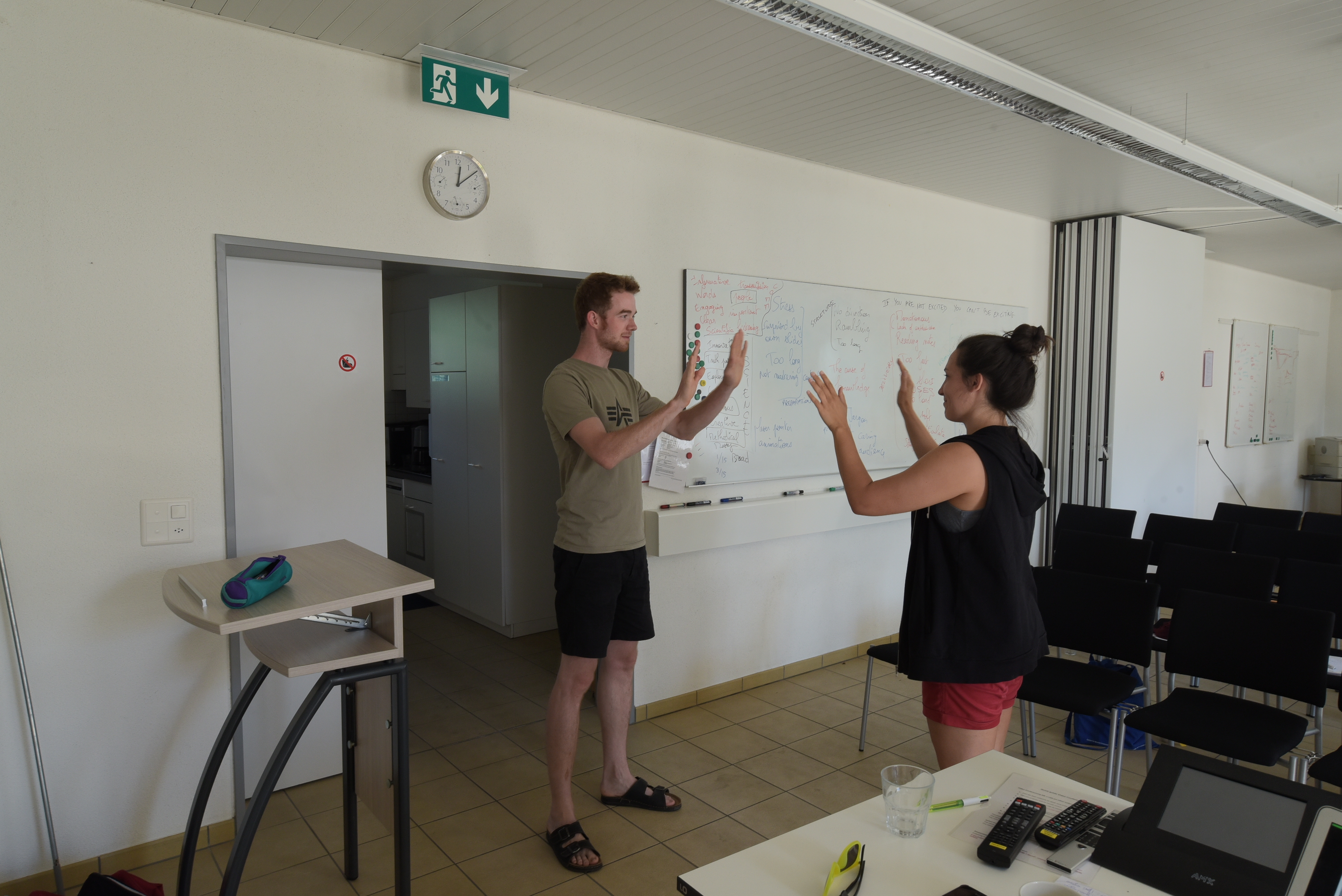
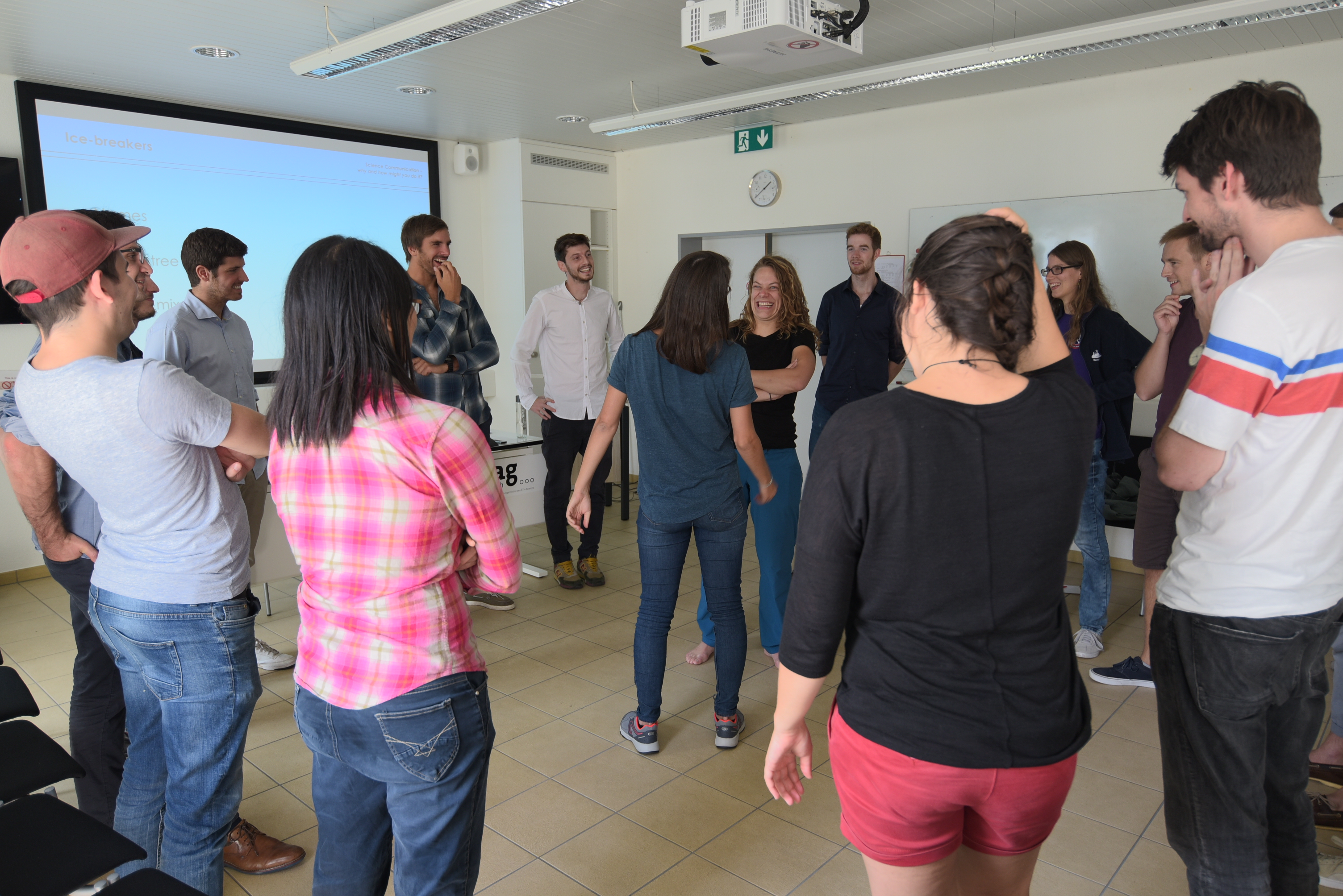
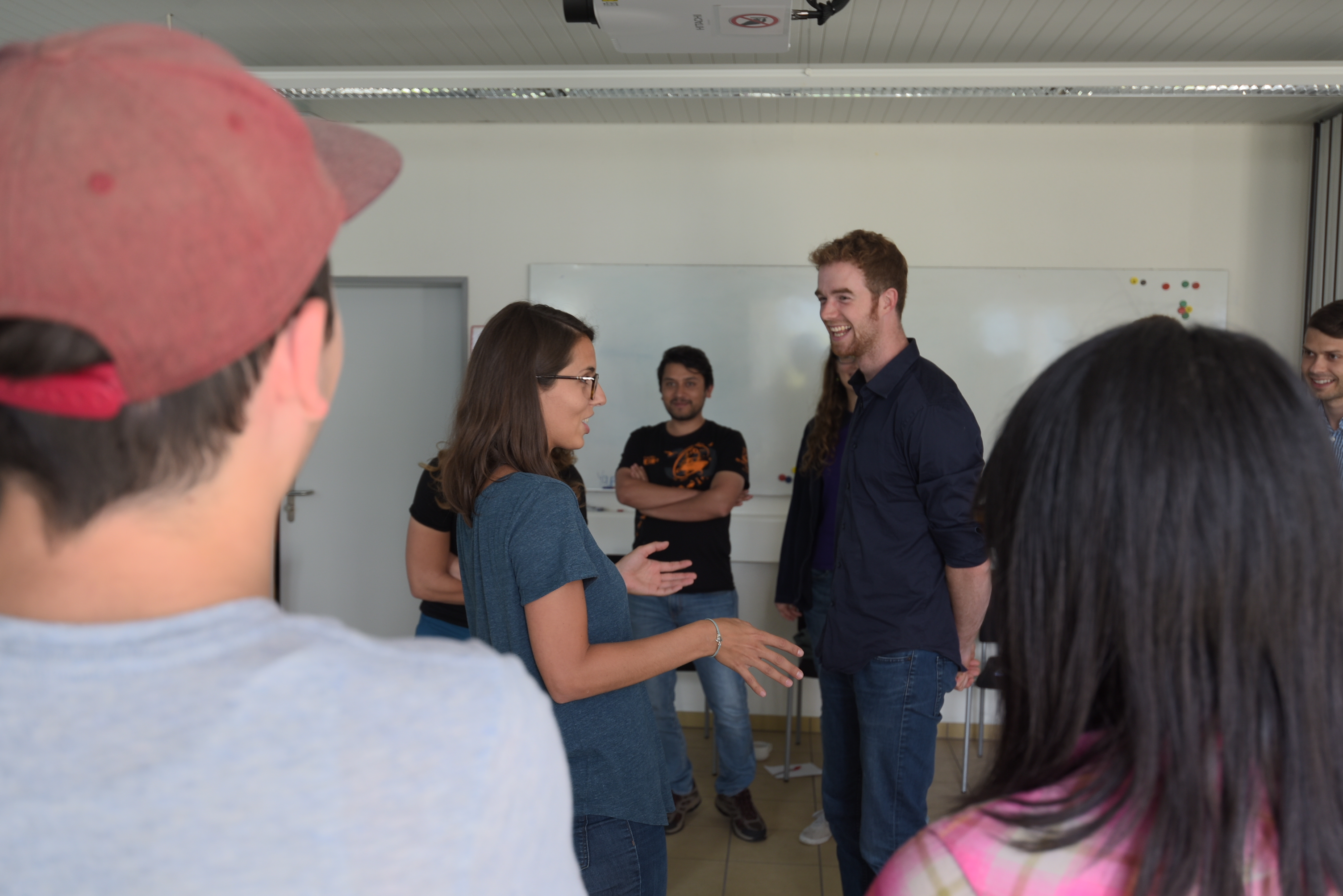
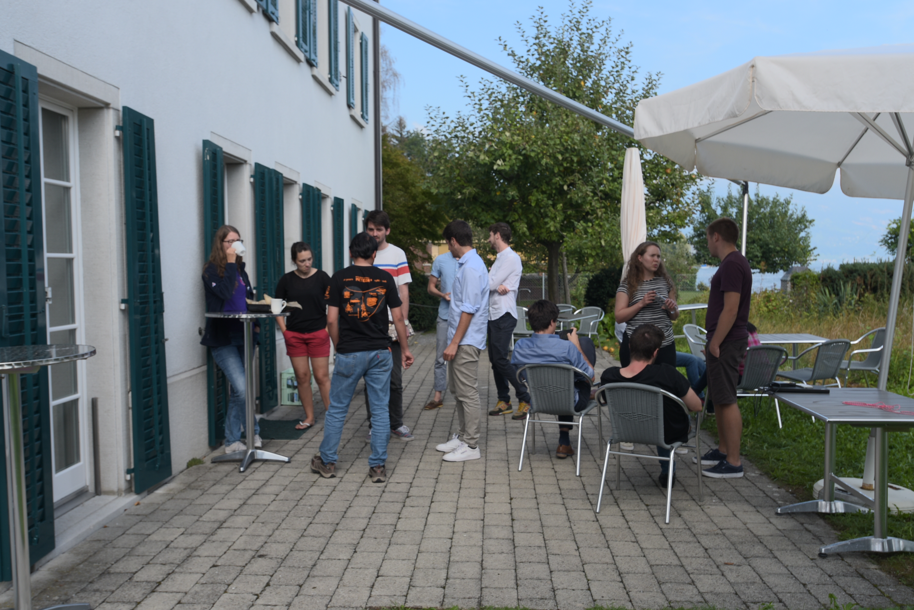
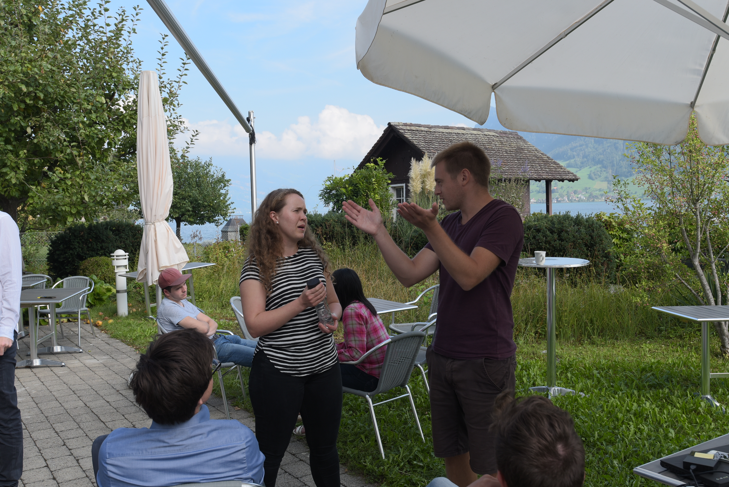
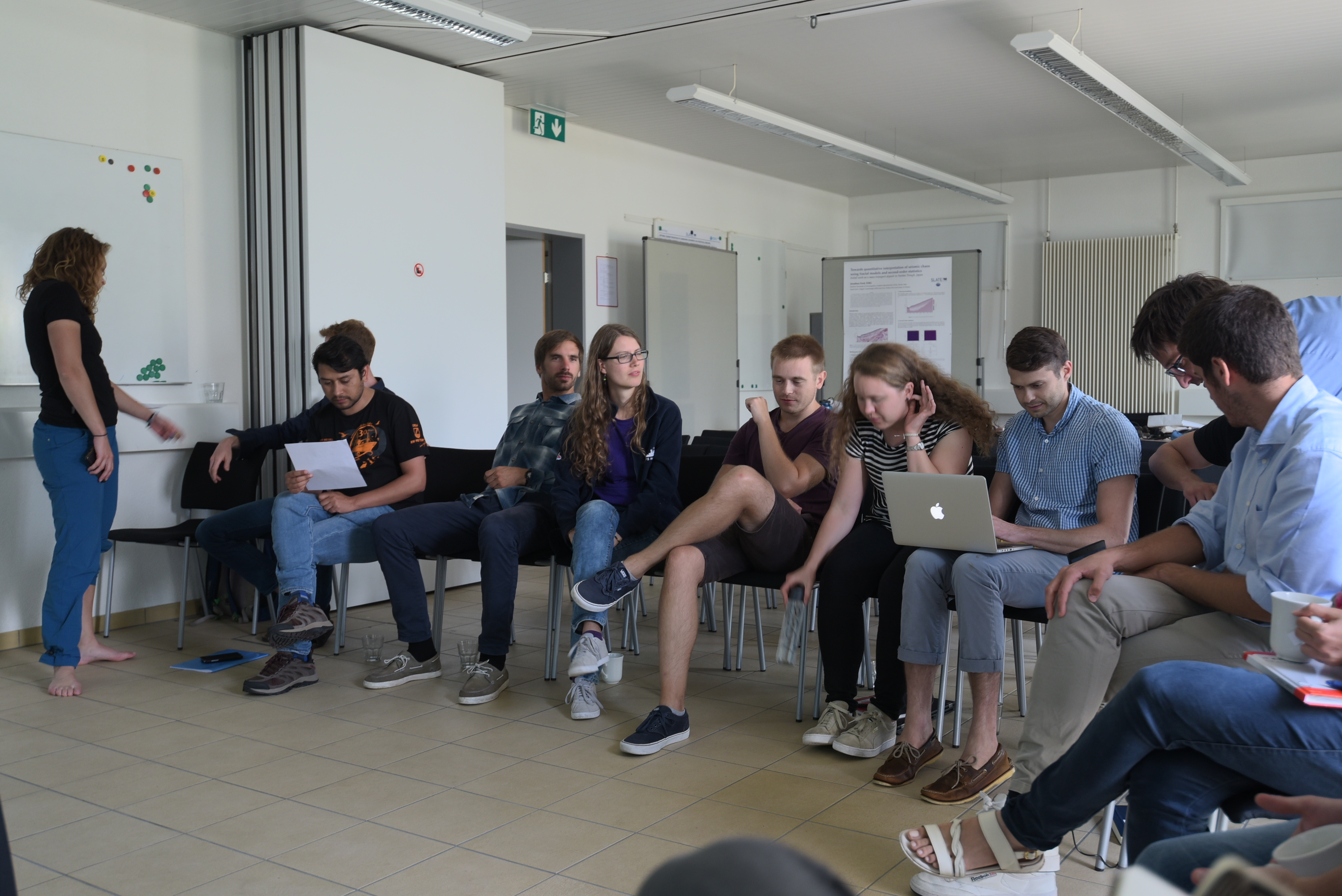
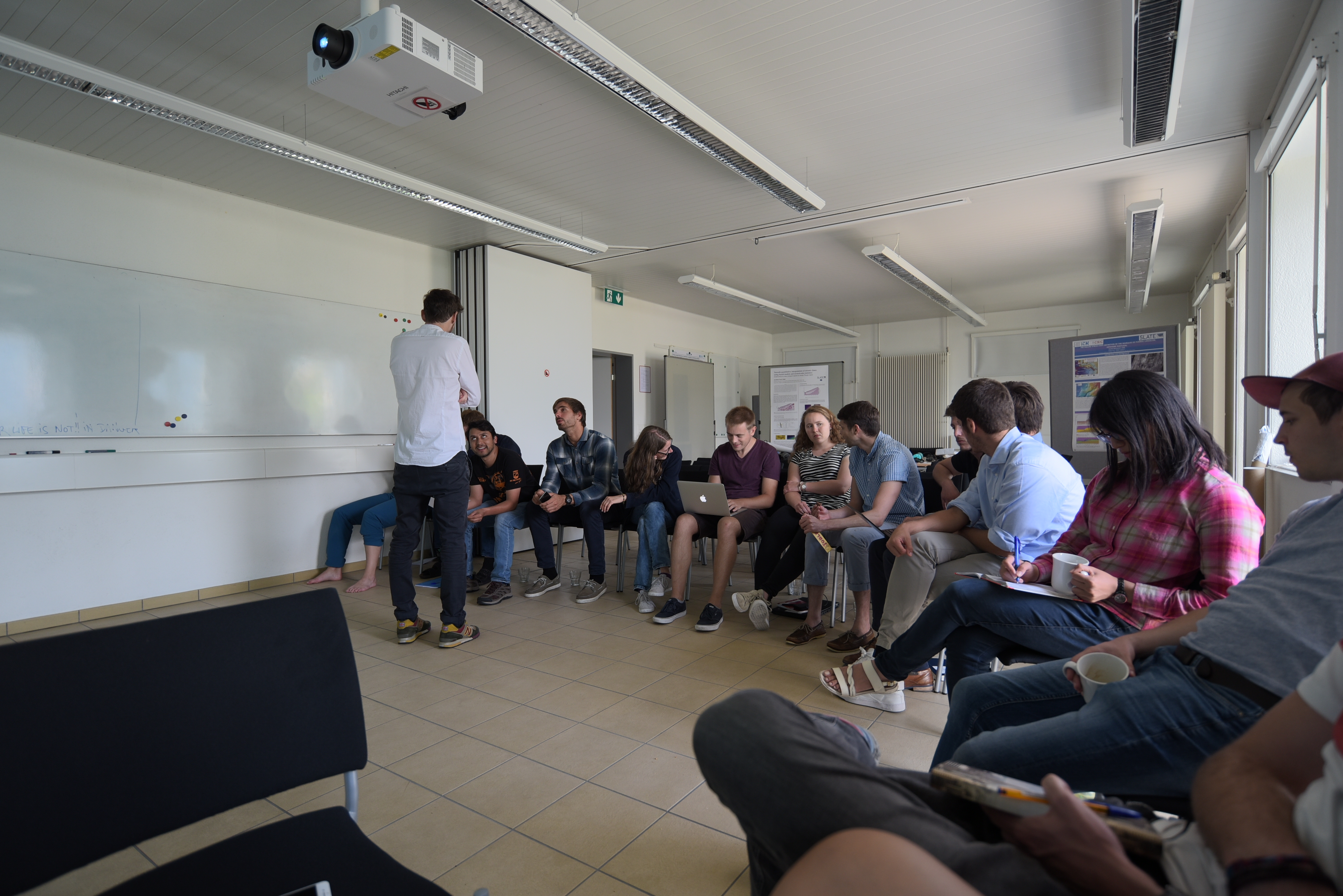
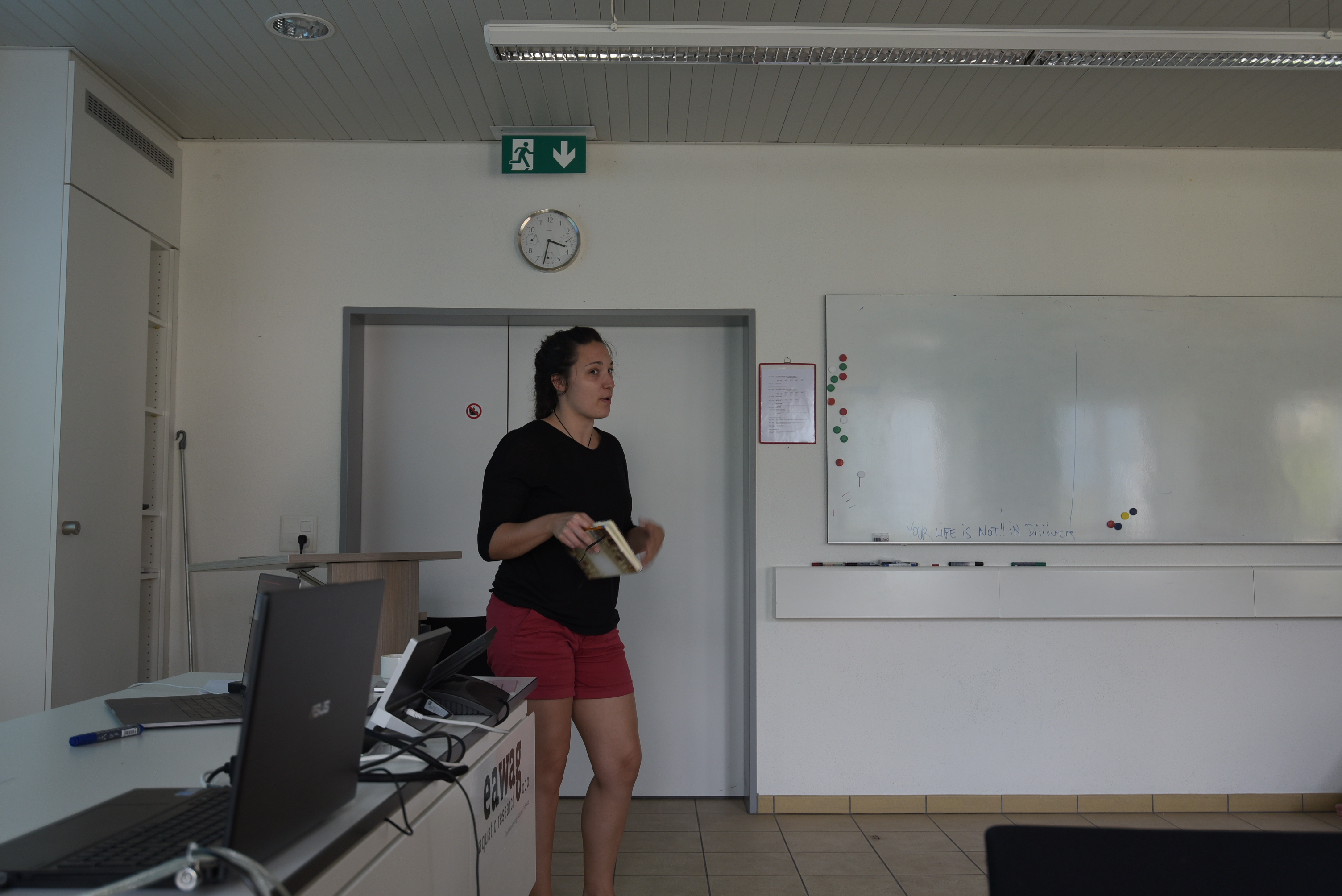
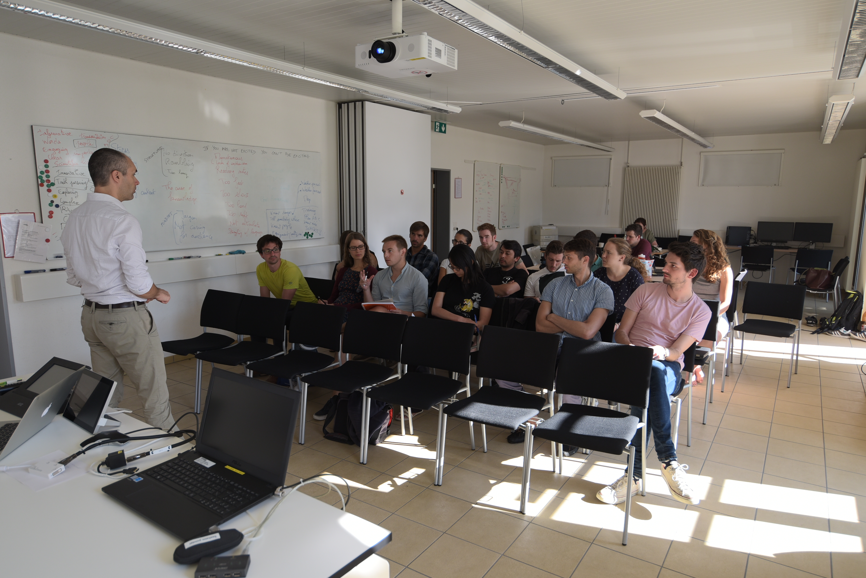
Aside from doing science, the annual workshops are an opportunity for the group to participate in specific training courses together. During the Lake Lucerne workshop, two members of The Catalyst—an improv comedy and science communication collective—visited to deliver courses focused on better communicating our work to the scientific community and the wider public.
“Established in 2012 in Lausanne, Switzerland, The Catalyst is a group of scientific researchers and professionals that uses entertainment as a means of engagement with the public.”
Presentation Skills for Scientists Samuel Lagier
Scientist / Science Communicator
Samuel Lagier
Scientist / Science Communicator
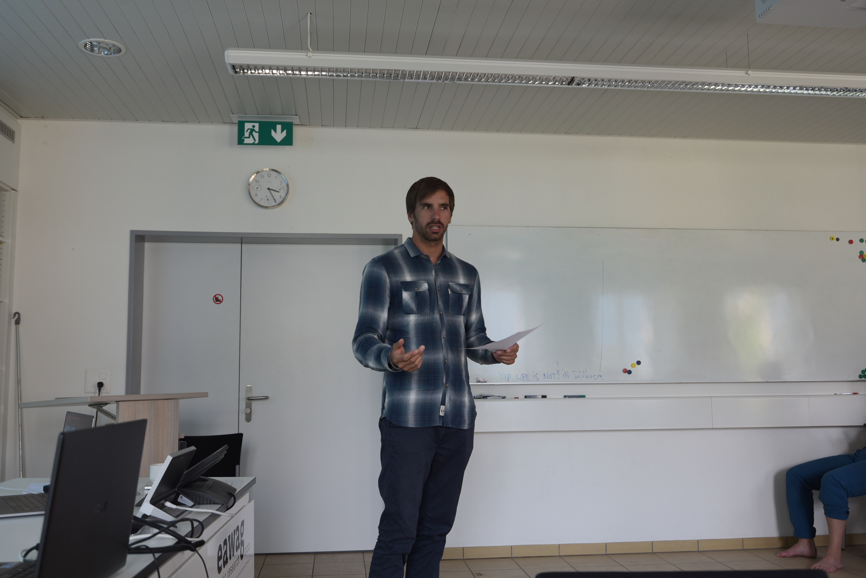
The presentation skills course started with a simple task: say your name and an object that you like and why you like it. The aim of this was for Samuel Lagier to learn our names, but also to show us how to create connections between a presenter and an audience—in this case through short personal stories. We then went on to discuss what makes a talk bad, and the basics of how to make a talk good. The main message of this course was to help us understand that a presenter is in a lot of ways like a mountain tour guide: they first need to be well prepared so that the whole group can arrive at the goal. In the case of the presenter this means that the audience has received and understood the message, for the success of a talk depends on what the audience gets out of it.
In order to make his own talk successful, Samuel applied various practical methods, such as challenging us to explain our research in less than ten words without technical terms, and to present this in front of the others. We also developed short stories as a group that highlighted how we as human beings tend to be interested in conflict and resolution. We as presenters should consider that a good way to relate our science to the audience is to show them the problem/challenge/question and then the solution.
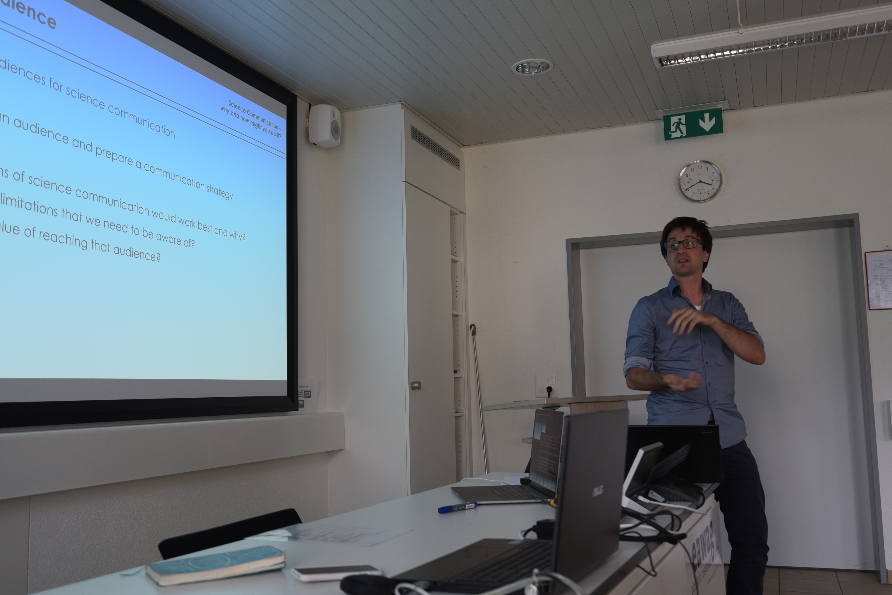
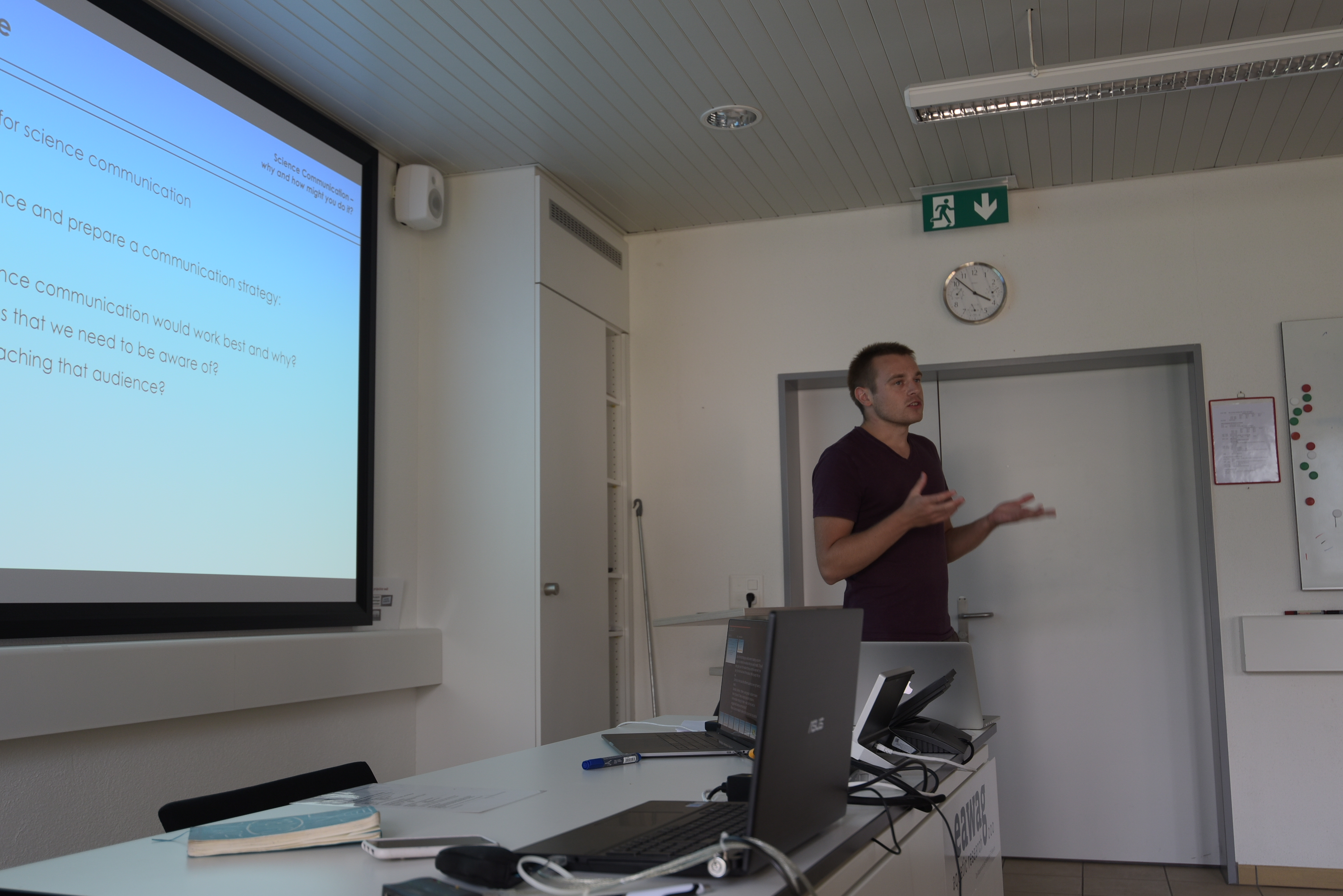
Science communication Robbie I'Anson Price
Filmmaker / Scientist / Science Communicator
Robbie I'Anson Price
Filmmaker / Scientist / Science Communicator
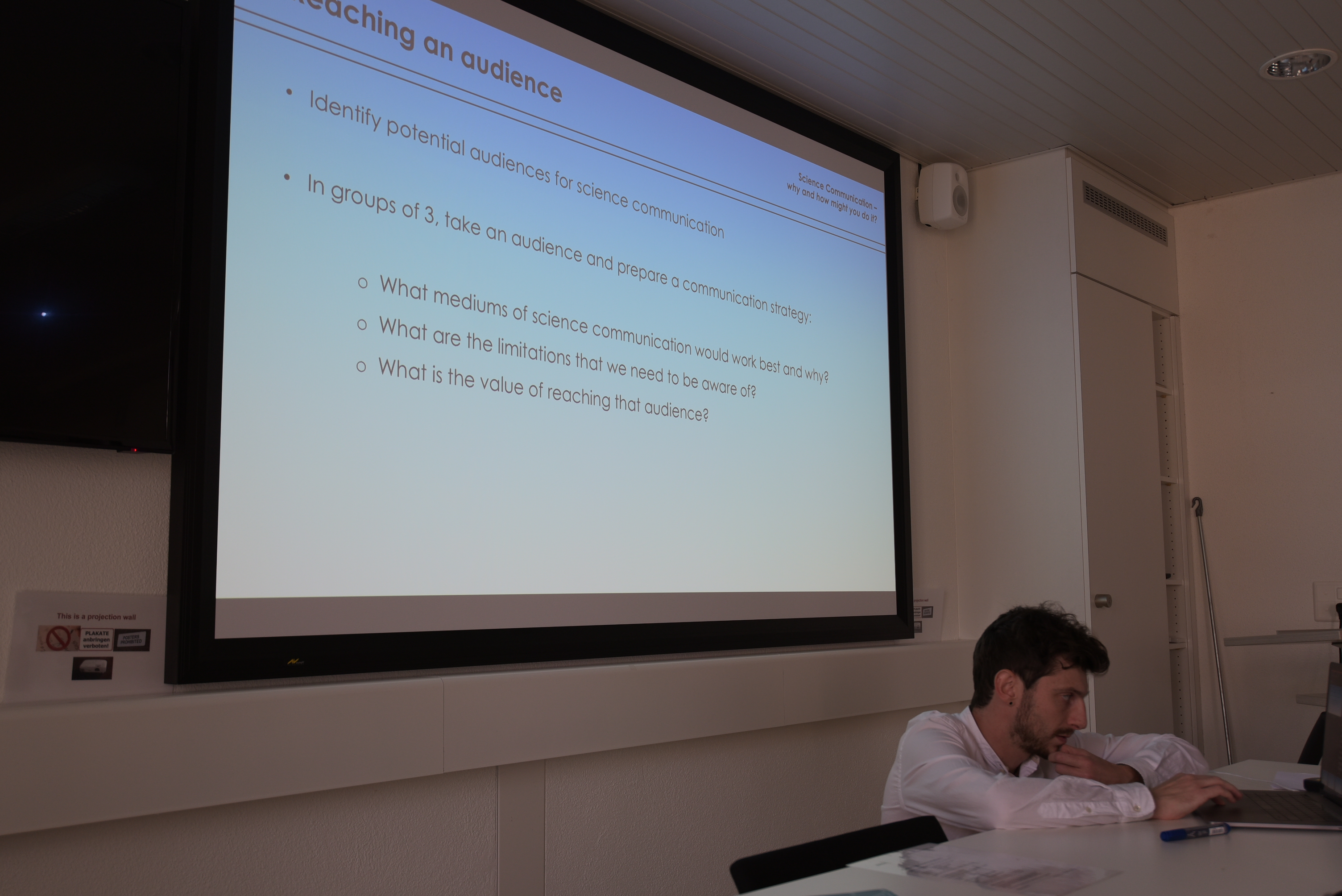
Communicating your work is perhaps one of the most important (and often overlooked) jobs of any scientist. Day 1 of this course challenged us to think about how we can effectively communicate our work to different parts of society: the general public, policy makers, business leaders and journalists. Submarine landslides are a significant geohazard, but much of the public are not even aware that they exist. As geoscientists we have an important role to play in communicating risk and information about natural hazards to the wider public.
The second day of the course Robbie took us out of our comfort zones and asked us to plan some scientific outreach—in the form of a short YouTube-style video. For many of us this was the first time even considering making a video about our work.
Robbie invited us all to apply to participate in the Exposure Science Film Hackathon, a three-day course designed to bring together scientists and filmmakers. The goal of the course is for each participating group to create a short but engaging film that communicates their science to a non-scientist audience. For further information about this project, application instructions and examples of previous films, please click here.
Related blog posts from the 'Lake Lucerne Workshop' blog series
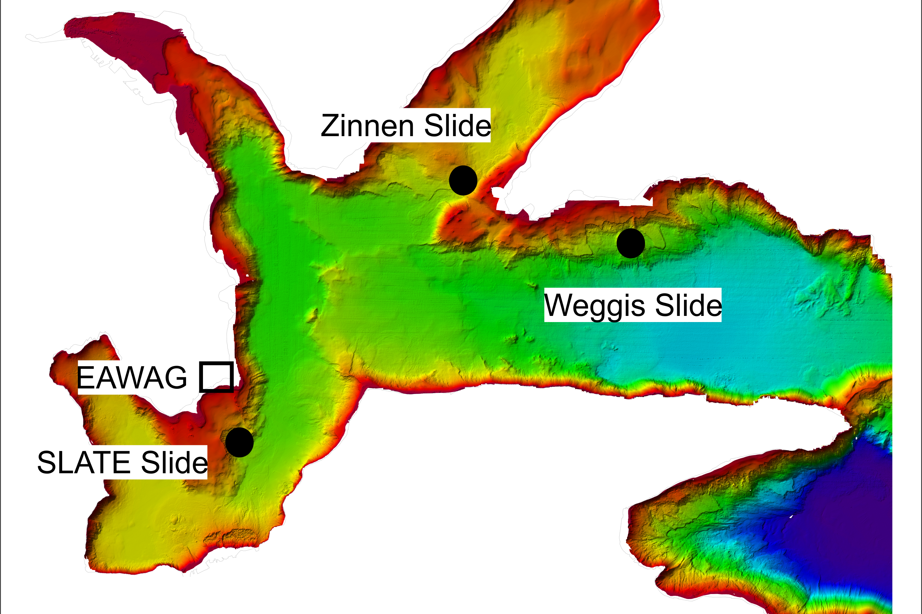
- EAWAG Kastanienbaum
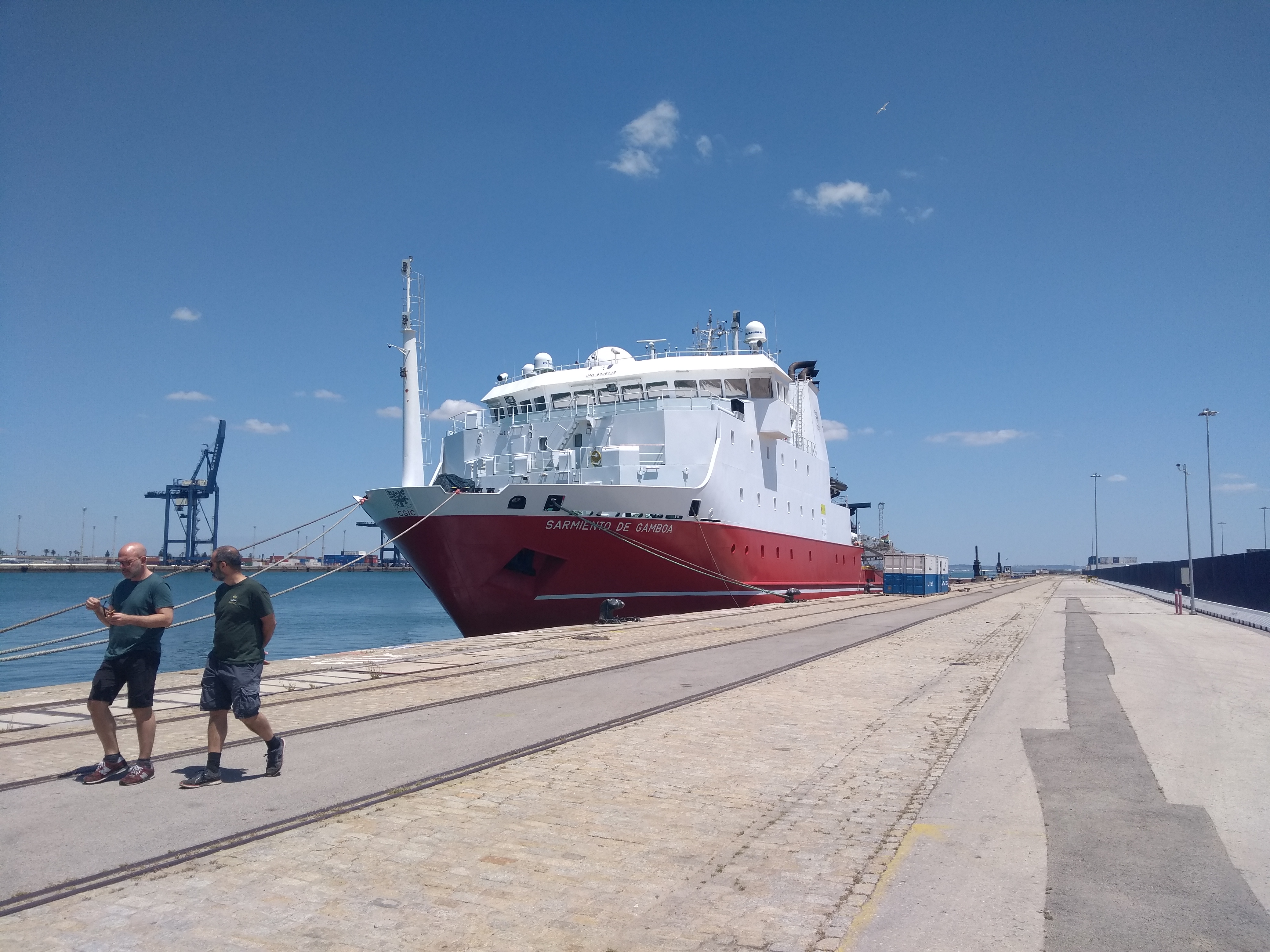
@ RV Sarmiento de Gamboa | 2018-06-18
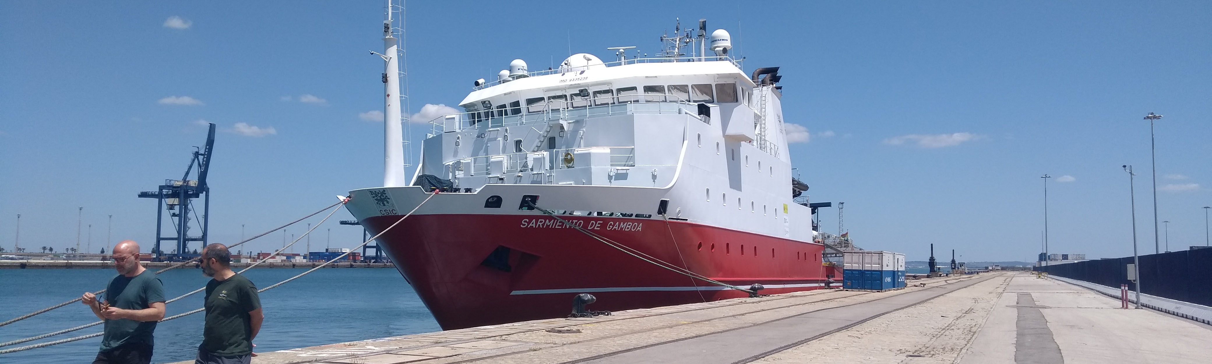
Impressions from leg 1 of the Insight cruise
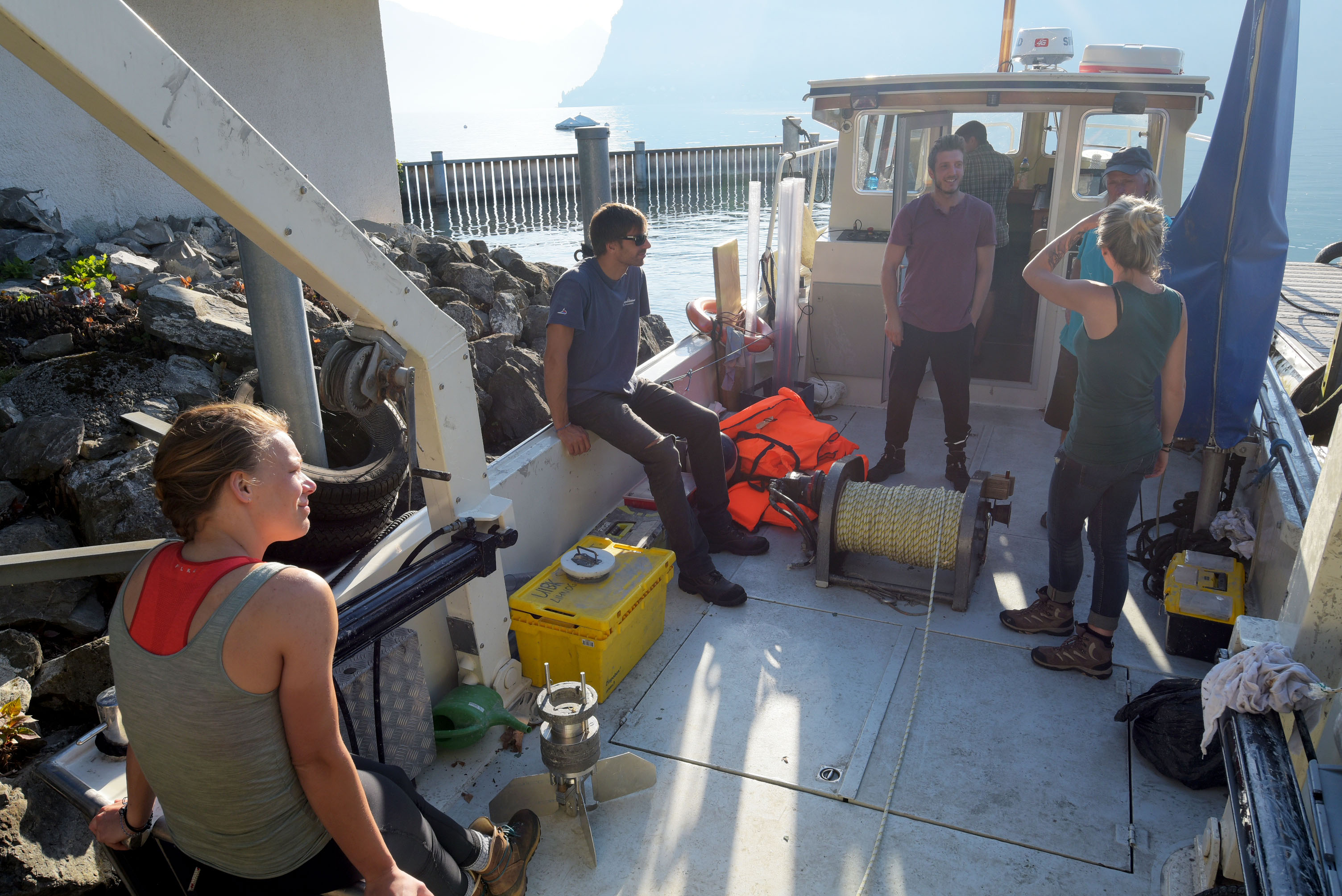
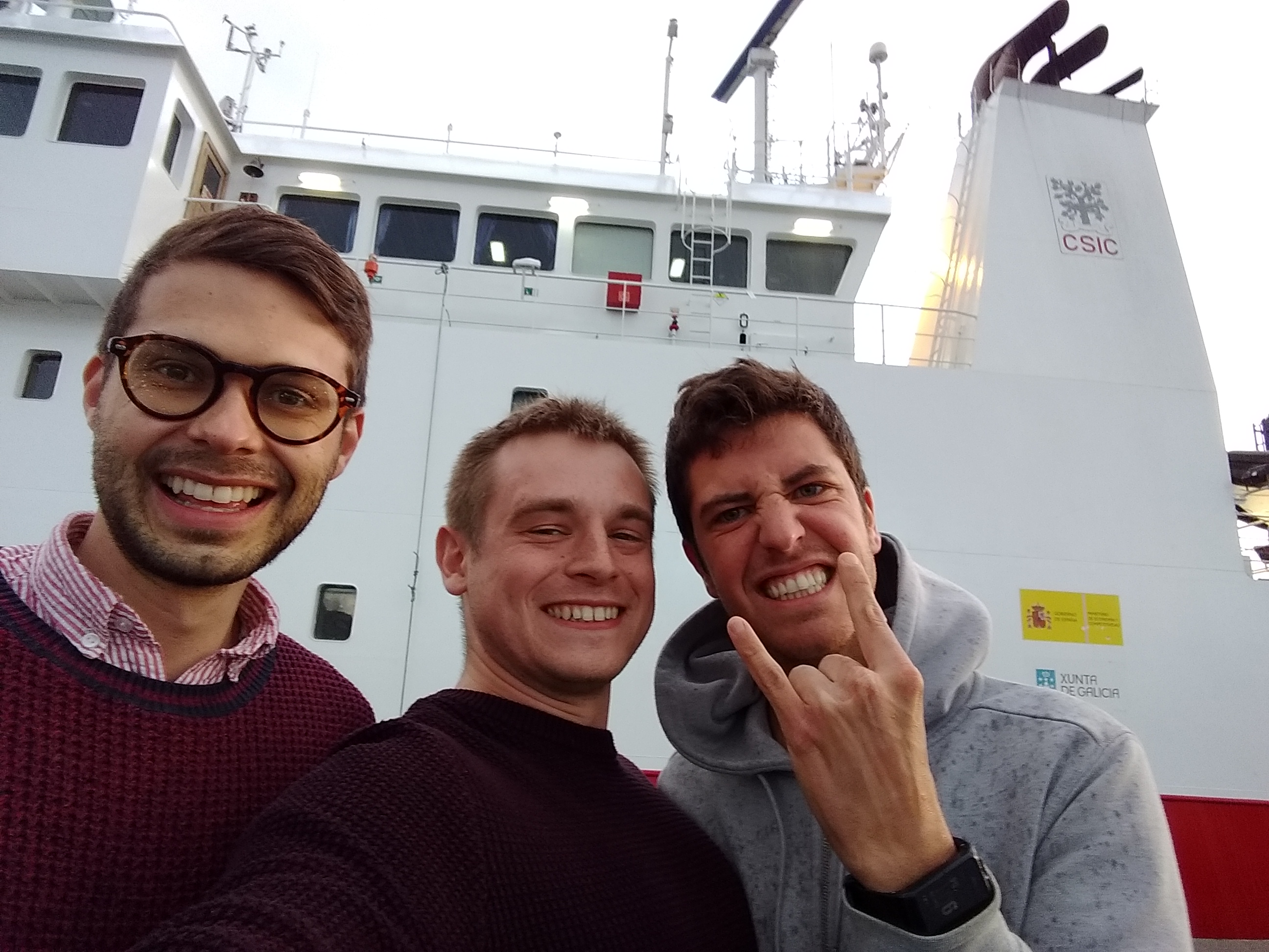
Jonathan Ford (ESR 2), Davide Mencaroni (ESR 6), William Meservy (ESR 12) | @ RV Sarmiento de Gamboa (April/May 2018)
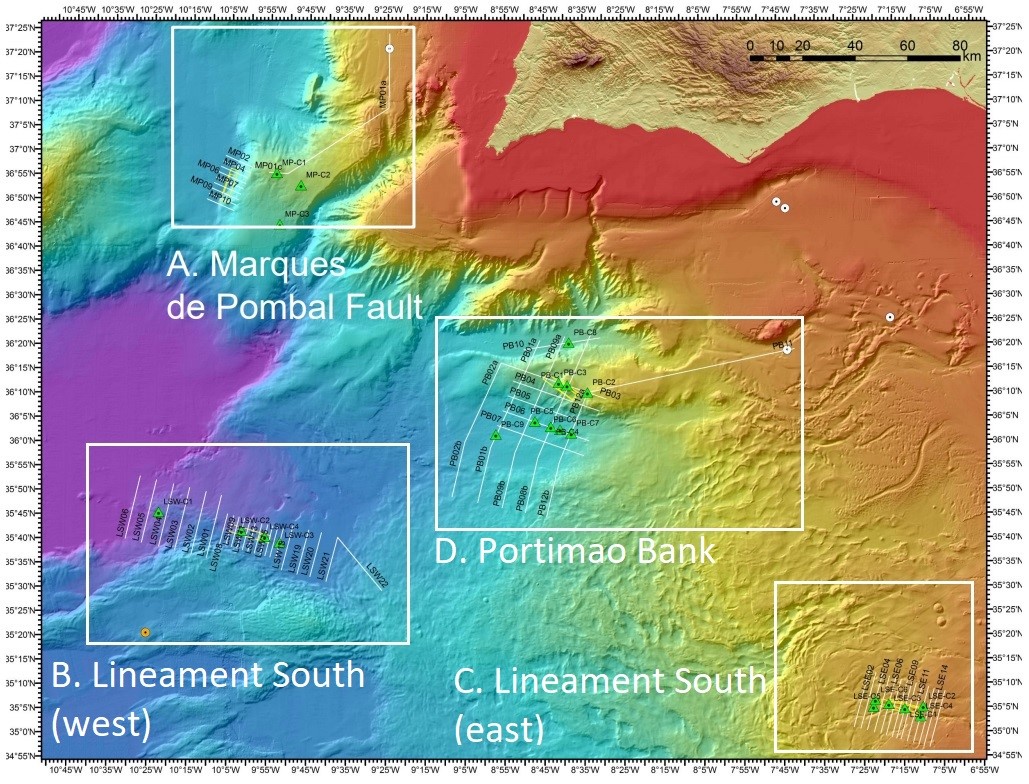
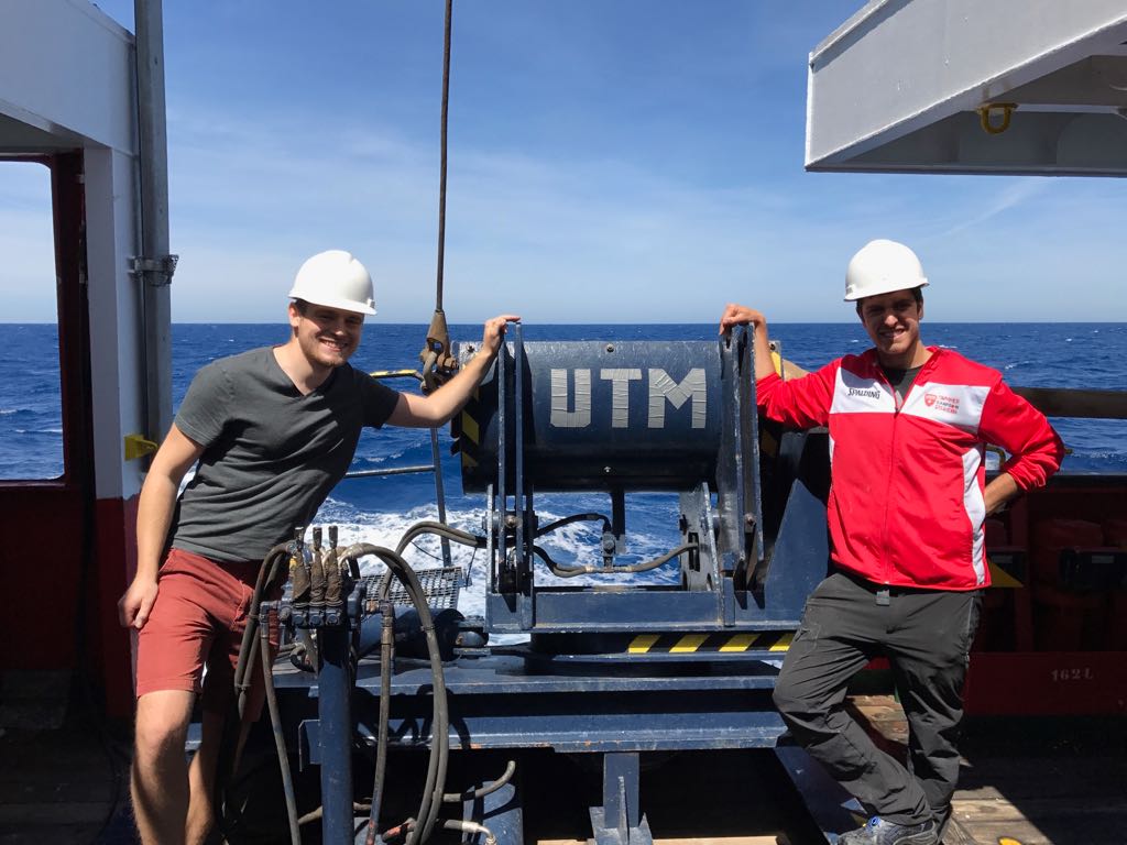
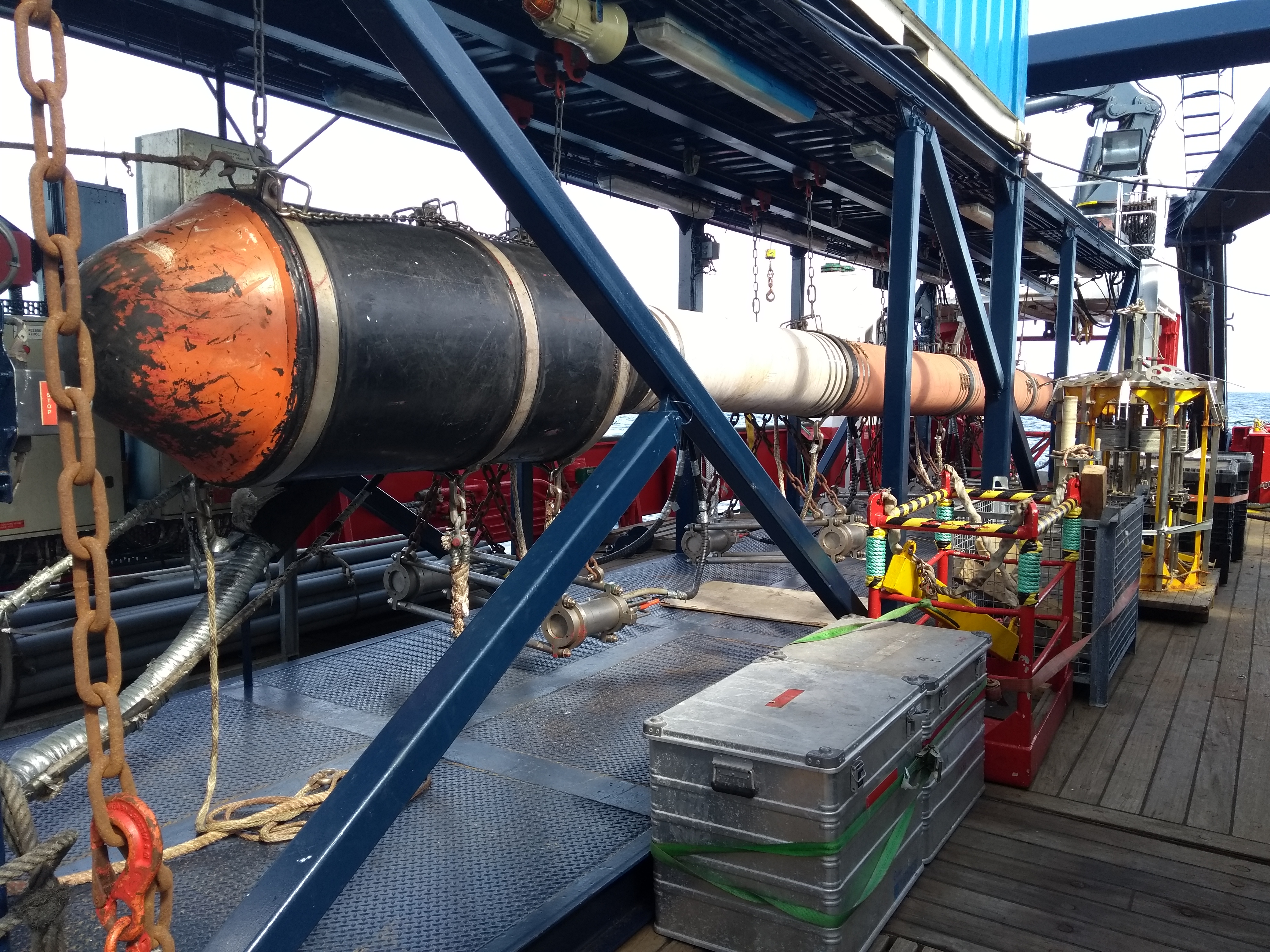
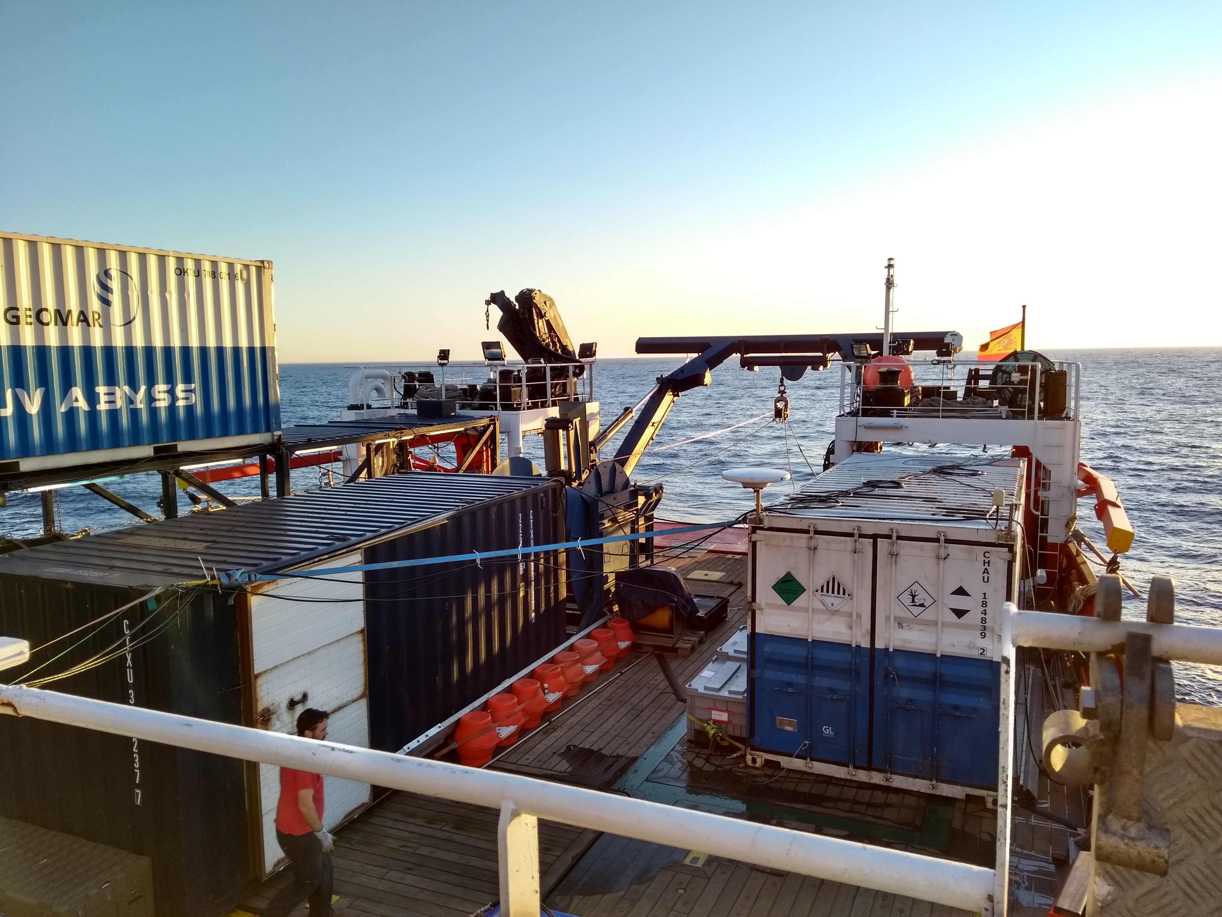
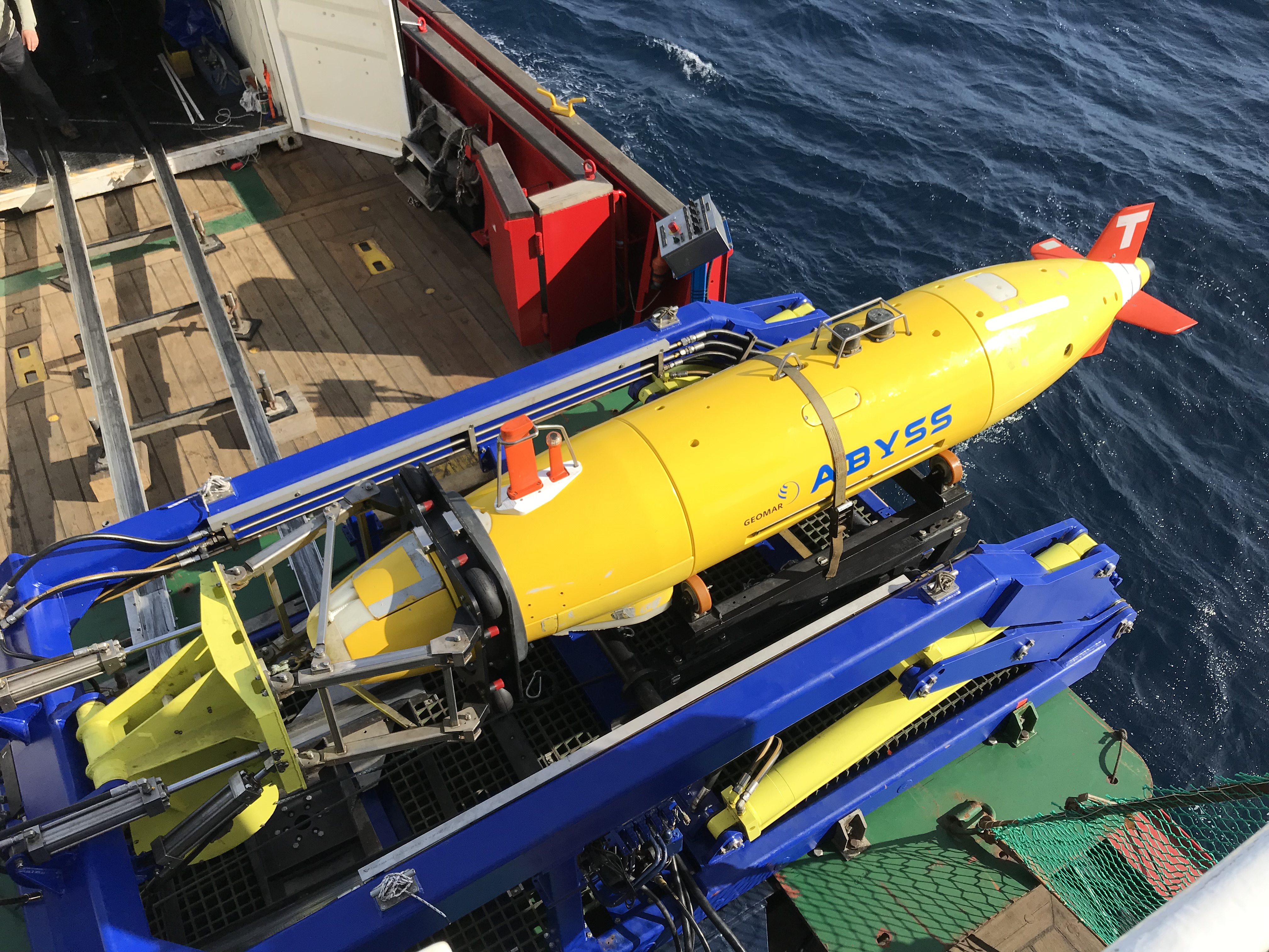
One of the goals of SLATE is to better understand geohazards related to submarine landslides. To achieve this, the network actively promotes the exploration of marine settings and SLATE members are encouraged to take part in oceanographic research cruises. We recently participated in the INSIGHT (Leg 1) cruise onboard the Sarmiento de Gamboa alongside principal investigators Eulália Gracia and Roger Urgeles.
The general objective of INSIGHT is to image and sample the seafloor and its subsurface to better understand the earthquake and tsunami hazard in the Gulf of Cadiz. To accomplish this, the Sarmiento de Gamboa was outfitted with seismic guns and streamers, sub-bottom profiler equipment, the AUV (autonomous underwater vehicle) “Abyss” from GEOMAR, and equipment to collect gravity cores of seafloor sediments.
Study areasThe cruise departed from Vigo, Spain on 29th April and spent several days at each area of interest collecting data:
Marques de Pombal Fault ZoneAn active thrust fault thought to be responsible for the 1755 Lisbon earthquake and resulting tsunami. This area is thought to have a particularly high submarine landslide hazard as there is evidence of repeated slope failure associated with the fault in the recent geologic record.
Lineament South (west)The west side of Lineament South, which marks the Eurasian - African plate boundary, was imaged and cored at several locations. Lineament South trends WNW-ESE and is a 3-6 km wide, dextral, strike-slip fault extending the length of the Gulf of Cadiz and cutting the entire sedimentary sequence, as well as separating two different types of oceanic crust. Portions of its western half that were previously explored during other campaigns found the formation of gas hydrates and presence of mud volcanoes: evidence of fluids rising from depth.
Lineament South (east)Close to the coast of Morocco, the eastern half of Lineament South traverses the accretionary wedge where the Eurasian plate subducts under the African plate. Additionally, just north of the fault, two large mud volcanoes and associated radial landslides were surveyed by the AUV.
Portimao BankA Mesozoic-aged, inverted half-graben that is flanked by multiple submarine landslides on its south side. These slides may be associated with the upwelling of a large, evaporitic dome structure called the Don Carlos Diapir. The Portimao Bank seamount is bound by active thrust faults on its north and south ends.
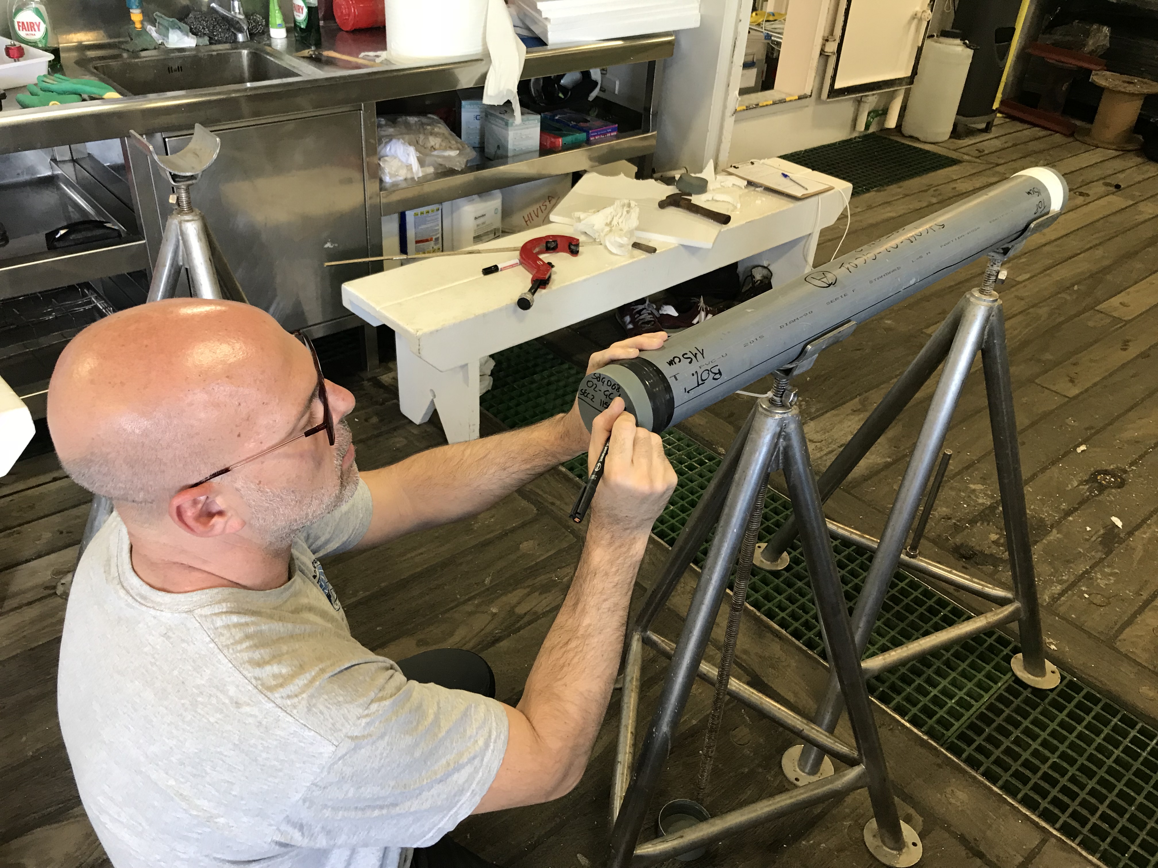
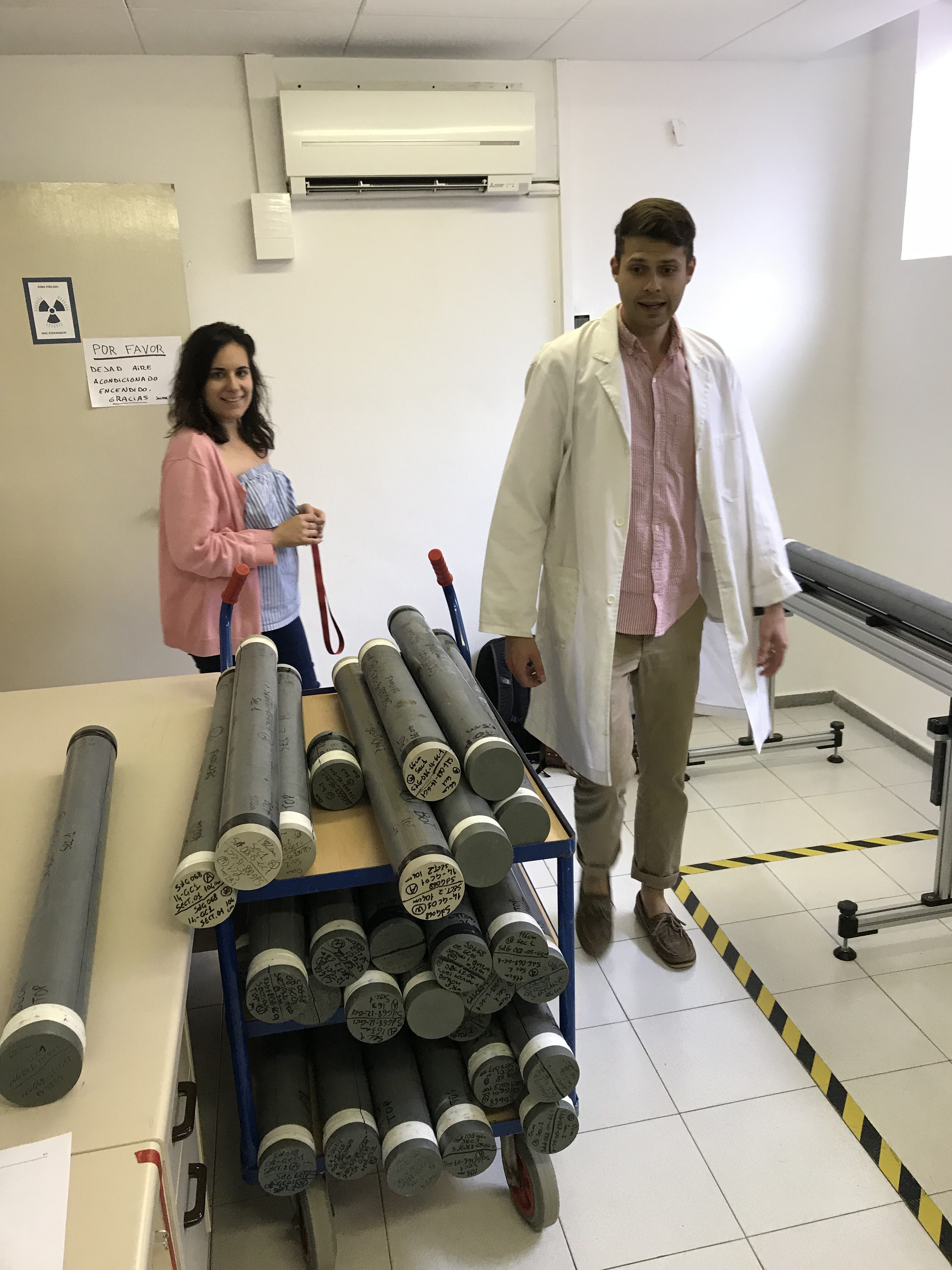
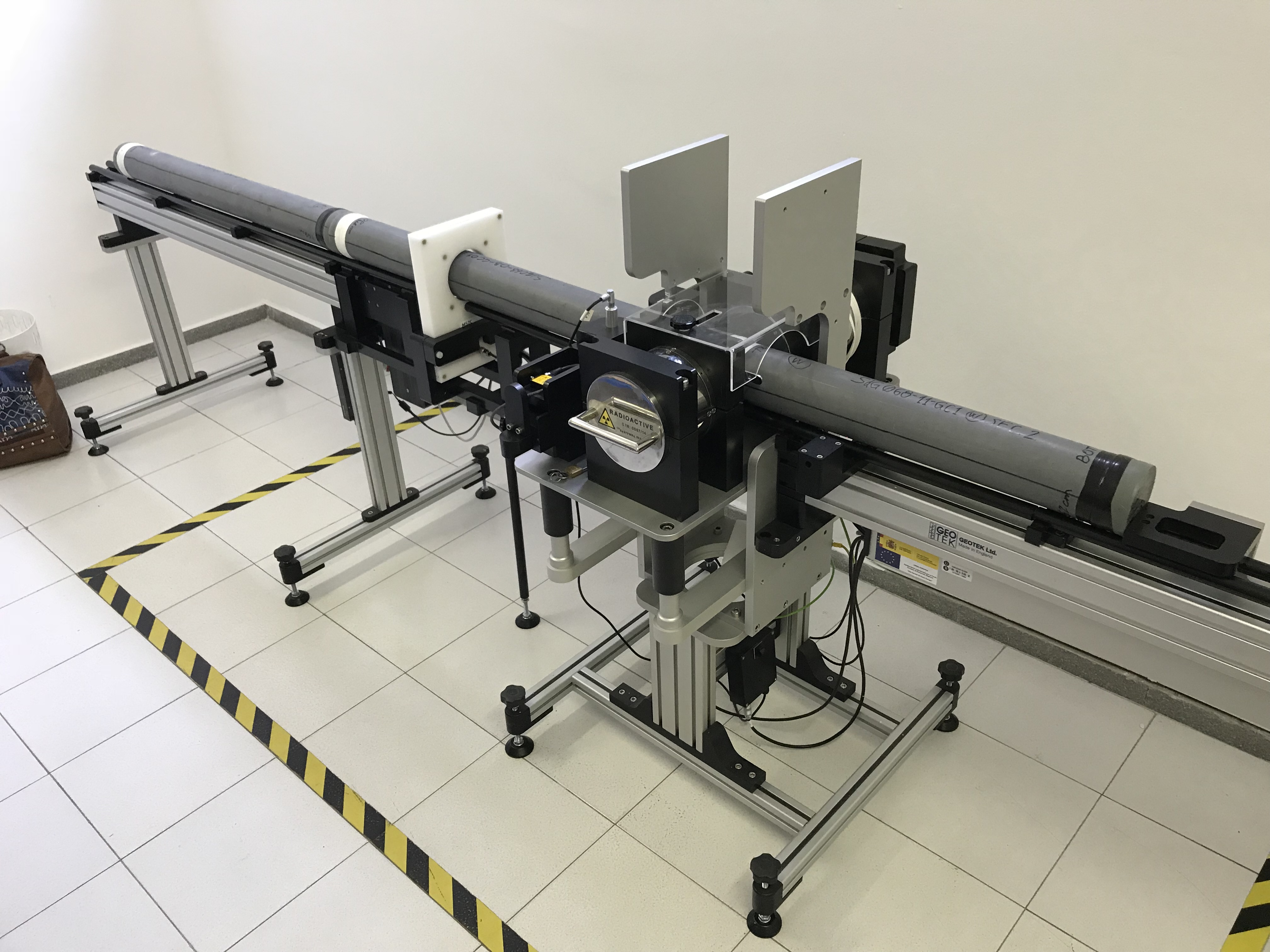
Science onboardDuring the expedition, all three of us assisted with gravity core acquisition, which involved cutting, sealing, and labelling each core into 1 m sections for further examination at the University of Barcelona. Here, Davide and William ran each unopened core through a Multi-Sensor Core Logger to measure geophysical properties like density, P-wave velocity, resistivity, and magnetic susceptibility. Future analyses require the cores be split, visually described, and then stored in a refrigerated archive at the Institute of Marine Science of Barcelona.
Additionally, each of us had different roles on the vessel:
"I worked with the acoustic instrumentation. The Sarmiento de Gamboa is equipped with multibeam and Parasound echosounders that allowed us to obtain high-resolution bathymetric images (with less detail, but greater coverage than the AUV) and sub-bottom profiles of the first few metres of sediment for each area of investigation and during transits. I was responsible for data acquisition, monitoring, and maintaining the observers logs. I also experimented with some preliminary filtering on the Parasound data to improve the imaging of the stratigraphy as much as possible." Davide Mencaroni
ESR 6
"My primary duty was to initiate and monitor the multi-channel seismic acquisition software. For each new line, after the streamers and airguns were deployed by the crew, I would initiate a “soft start” or step-by-step increase of the number of guns being fired until the entire array could be fired simultaneously every 6-7 seconds. Gradual airgun buildups like this are common protocol for seismic exploration and are done to gently warn away nearby marine mammals that may be uncomfortable with the sound of the airguns. After the airguns were fully engaged, my responsibilities would shift to ensuring that the ship was on course and initiating, monitoring, and occasionally trouble-shooting the acquisition software."
Davide Mencaroni
ESR 6
"My primary duty was to initiate and monitor the multi-channel seismic acquisition software. For each new line, after the streamers and airguns were deployed by the crew, I would initiate a “soft start” or step-by-step increase of the number of guns being fired until the entire array could be fired simultaneously every 6-7 seconds. Gradual airgun buildups like this are common protocol for seismic exploration and are done to gently warn away nearby marine mammals that may be uncomfortable with the sound of the airguns. After the airguns were fully engaged, my responsibilities would shift to ensuring that the ship was on course and initiating, monitoring, and occasionally trouble-shooting the acquisition software."
 William Meservy
ESR 12
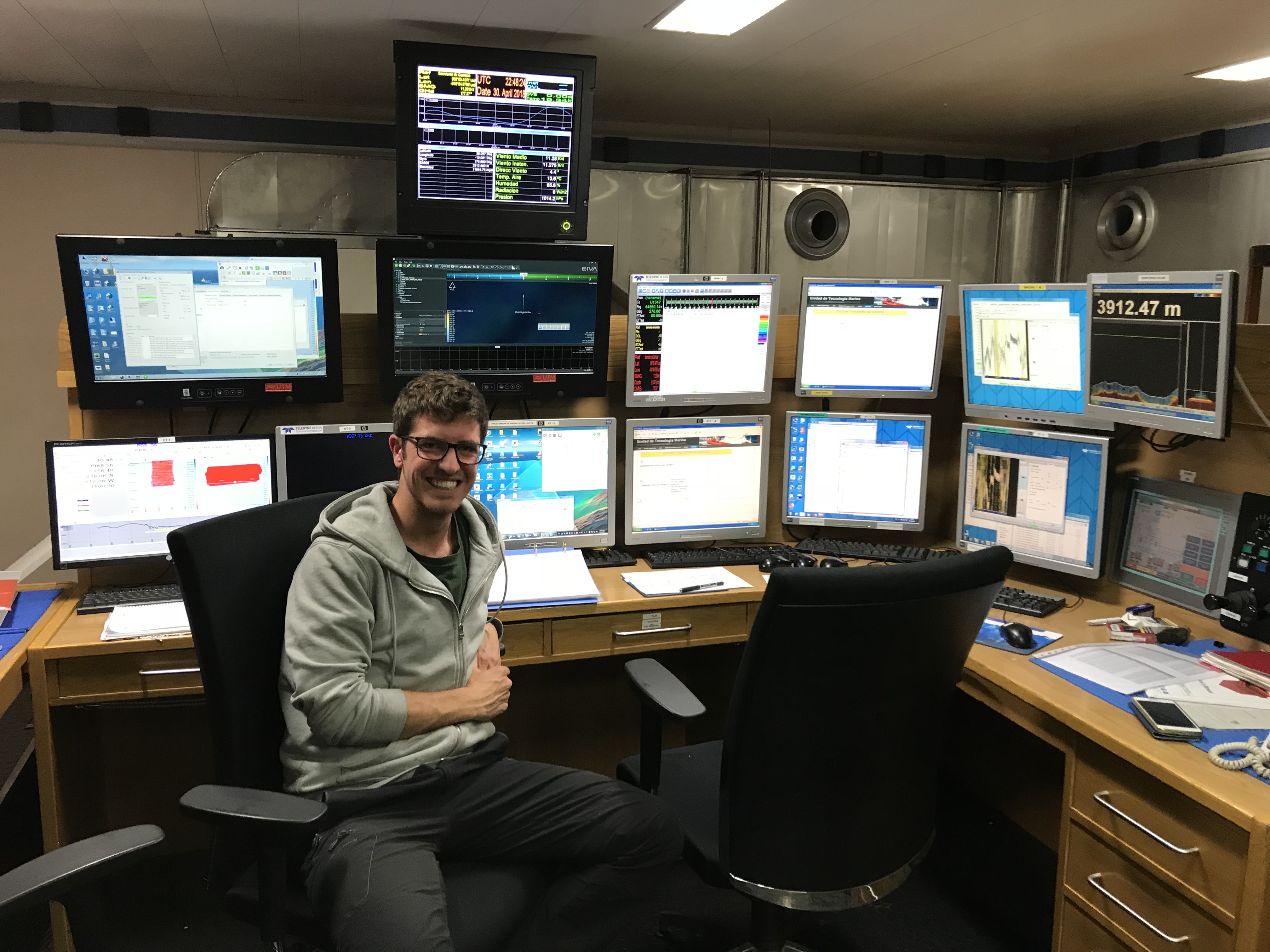
"My role onboard was as part of the seismic processing team. Multi-channel seismic data are processed immediately after acquisition to check for data problems and ensure that targets have been imaged correctly. The main tasks onboard are i) QC and smoothing of the GPS navigation ii) QC of raw field records, noting the amount and types of noise present in the data iii) basic processing, including an initial pass of velocity analysis and migration. A more detailed processing flow will be applied onshore to further improve the image."
Jonathan Ford
ESR 2
Scientific impact
William Meservy
ESR 12
"My role onboard was as part of the seismic processing team. Multi-channel seismic data are processed immediately after acquisition to check for data problems and ensure that targets have been imaged correctly. The main tasks onboard are i) QC and smoothing of the GPS navigation ii) QC of raw field records, noting the amount and types of noise present in the data iii) basic processing, including an initial pass of velocity analysis and migration. A more detailed processing flow will be applied onshore to further improve the image."
Jonathan Ford
ESR 2
Scientific impact
Enjoying generally good weather conditions and no major technical problems during the cruise contributed to the successful acquisition of a significant amount of new data. These include >1000 km of high resolution 2D multi-channel seismic lines and sub-bottom profiles, >100 km2 of high resolution AUV bathymetry, and 16 gravity cores. These data will be used by scientists who took part in the expedition for a wide variety of projects, including research related to seismic risk assessment on active faults, submarine slope stability, mud volcanoes, and environmental reconstruction based on deep-water corals.
For the SLATE network specifically, this campaign has been crucial for collecting data to be used in the study of the Marques de Pombal landslide (ESR6), for the creation of a landslides catalog in the Southwestern Iberian Margin (ESR12), and for new high-resolution seismic images of internal structure within submarine landslide deposits (ESR2).
Work areas- Marques de Pombal Fault Zone
- Lineament South (west)
- Lineament South (east)
- Portimao Bank
 Vessel
Impressions
Vessel
Impressions
@ MARUM, Bremen, Germany | 2018-06-18
Review of the ECORD Training Course 2018: "Virtual Ship Experience"
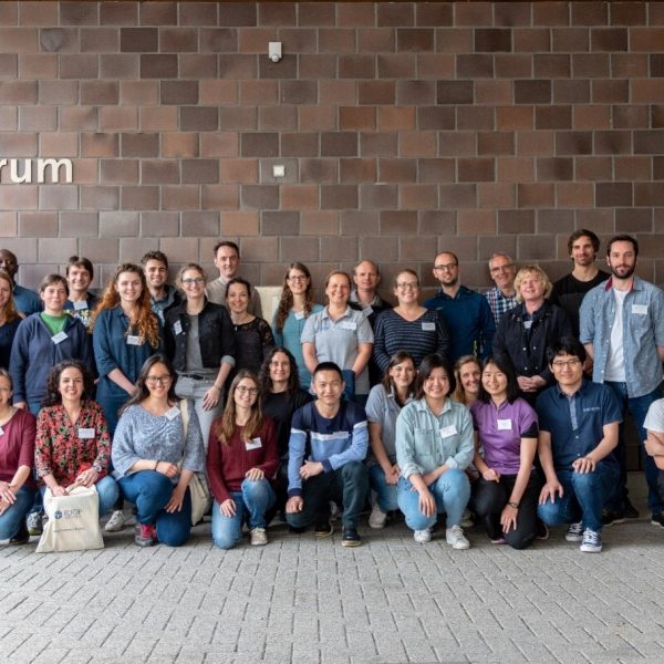
Shray Badhani (ESR 4), Monika Wiebe (ESR 11), Ting-Wei Wu (ESR 7) | @ MARUM, Bremen, Germany (23-27 April 2018)
From 23rd to 27th April, a group of seven SLATE ESRs participated in the ECORD Training Course 2018, which took place at MARUM – Center for Marine Environmental Sciences, Bremen. The first thing we had to get used to during this course was the number of abbreviations - ECORD, IODP, BCR, MSP, LWD, MSCL, and so on – it was easy to get confused there.
First of all, ECORD is short for European Consortium for Ocean Research Drilling, which consists of 14 European countries and Canada. It is also part of IODP – the International Ocean Discovery Program, a collaboration of 23 nations. IODP conducts research expeditions world-wide that recover sediment and hard rock cores from the seafloor in order to explore and solve scientific questions. The recovered cores are first processed onboard and then analysed onshore. Finally they are stored in one of the three core repositories, one of which is located at MARUM in Bremen. The Bremen Core Repository (BCR) hosts all cores from the North and South Atlantic Ocean; it presently contains 156 km of IODP cores from 90 expeditions.
The idea of the ECORD Training Course is to prepare and train young scientists for life and work aboard an IODP expedition. In total we were 31 participants, mainly PhD students, from different fields out of the marine sciences. The course provided us with a one-week “Virtual Ship Experience” focusing on the various methods used to analyse cores on board, but also on life on an IODP ship, and how to write an IODP proposal. It consisted of four main parts:
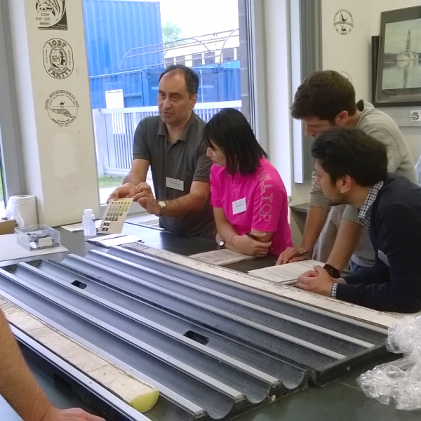
1. Introduction to IODP and ECORDThe course started with a general welcome, introduction and information part. Ursula Röhl, Rüdiger Stein and Holger Kuhlmann introduced us to the structure and objectives of IODP and ECORD as well as the purpose of this training course. Even though it was also a bit confusing, it was interesting to hear about what has to happen and how all the different panels and boards work together until an expedition can actually take place. In the end of this introductory session, Dierk Hebbeln took us on a tour through the MARUM. We visited the IODP core repository and also had a look at the different kinds of marine technology that are developed and applied by the MARUM, including the MeBo drill rig.
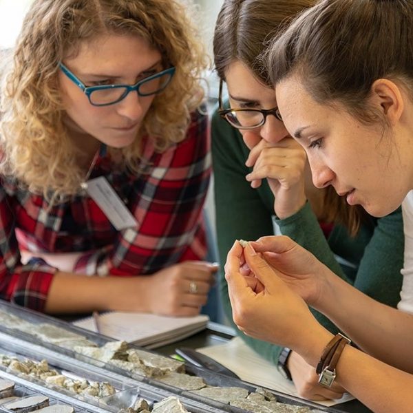
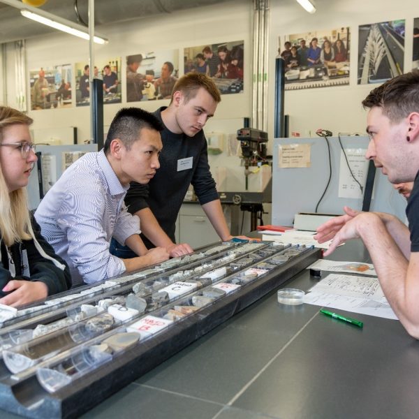
2. Virtual shipboard work at BCR/MARUMIn this part we learned how to work on cores on board. One of the most important parts is the core description. Core description is the first thing to do when the cores are obtained on deck before sediment properties begin to change afterwards. Visual observation at the time when the cores are still “fresh” can only rely on the skills of the describers. After the core description, the cores are placed on the machines (e.g. Multi-Sensor Core Logger, MSCL) for core logging, high-resolution linescan imaging and color scanning, and then sampled for different methods to obtain other physical and chemical properties. For example, pore water acquisition and analysis can provide us with concentration data such as salinity, nutrients, PH, alkalinity, ammonium, chloride, and sulphide. Smear slide analysis is a very simple and inexpensive way to determine some major components (e.g. sediment type and diatom data) of fine-grained sediments under the microscope. Biostratigraphy also uses microscopes but focuses on correlating and assigning relative ages of sediments by using the fossil assemblages contained within them.
3. Introductory seminars to general shipboard activitiesIn addition to these lab turns which were done in small groups, we also had seminars as a whole group. These gave us some more information as to what exactly happens on an IODP expedition. One of the most interesting and memorable talks was held by Oscar Romero who gave us a lively report of a recent expedition he attended, JR374. This expedition on IODP vessel JOIDES Resolution went from New Zealand to the West Antarctic ice sheet in order to investigate climatic and oceanic changes. With his pictures and stories Oscar Romero gave us a good idea on how both work and leisure time is spent on an IODP expedition. In this part we also learned how to obtain data and samples from previous expeditions, and did some practical work on core correlation and splicing. This is a method that ensures that a complete record is obtained by drilling more than one hole on one site.
4. Interactive session on defining drilling targets and strategies including drilling proposal writingA successful IODP proposal needs a great idea, lots of planning, and execution at the right time due to the geographical location of the drilling vessels. In this session, we were given a general idea of a timeline of a successful IODP proposal and an introductory seminar on proposal writing. Our group was then asked to form small teams of 5-6 participants to write a short proposal and present it in front of the rest of the group and the lecturers. It was a challenging task for all of us since we all had different scientific backgrounds and had to find a way to present the ideas of the whole team. However, we were told that the most successful proposals are usually the ones which have the most multi-disciplinary objectives.
Overall the ECORD training course was a success and provided all of us with new knowledge and understanding as to what IODP is and does, and how we personally can use the acquired data or get involved.
"It is very useful to know how to work with different disciplines on board. I learned the orders of experiments and how a cruise mission is organized. I think the most precious part of the course is that it strengthened my skills to communicate and cooperate with researchers with different backgrounds." Ting-Wei Wu
ESR 7
"As a geophysicist, I spend most of my time working behind a computer -- so getting some "hands on" experience working with the cores and the laboratory analysis was great. I hope to use downhole logs and physical property measurements from the NanTroSEIZE expeditions during my PhD. For me it was very useful to learn more about the core handling and data archiving procedures, particularly around splicing core sections. I would recommend this course to anyone who plans to use any IODP datasets, as it was an excellent overview of the technical operations and wider scientific goals of the programme."
Jonathan Ford
ESR 2
“The IODP Training Course was very instructive; especially to learn more about all the analyses proceeded on the cores from the recovery until the storage. Even if some of the methods used were familiar to me, I found it very interesting to see how they use these methods during an IODP cruise and how a day on board for each of them looks like. I particularly liked the hard rock core description, which was a step back in time to my first year at university and was a pleasant experience. In addition, I was very surprised by the biostratigraphy course, which the speaker made very interesting. Overall, it was a great experience, the team was really nice and the course made me want to participate in IODP expeditions.”
Ting-Wei Wu
ESR 7
"As a geophysicist, I spend most of my time working behind a computer -- so getting some "hands on" experience working with the cores and the laboratory analysis was great. I hope to use downhole logs and physical property measurements from the NanTroSEIZE expeditions during my PhD. For me it was very useful to learn more about the core handling and data archiving procedures, particularly around splicing core sections. I would recommend this course to anyone who plans to use any IODP datasets, as it was an excellent overview of the technical operations and wider scientific goals of the programme."
Jonathan Ford
ESR 2
“The IODP Training Course was very instructive; especially to learn more about all the analyses proceeded on the cores from the recovery until the storage. Even if some of the methods used were familiar to me, I found it very interesting to see how they use these methods during an IODP cruise and how a day on board for each of them looks like. I particularly liked the hard rock core description, which was a step back in time to my first year at university and was a pleasant experience. In addition, I was very surprised by the biostratigraphy course, which the speaker made very interesting. Overall, it was a great experience, the team was really nice and the course made me want to participate in IODP expeditions.”
 Tugdual Gauchery
ESR 3
“I applied to the course without really knowing what to expect and how it might help me in my research. Now I am glad that I had the chance to attend, as it really helped me to understand better what kind of data is obtained and why. For me the physical properties sessions were the most important ones as I am using this data and now know better how to work with it. I also highly enjoyed the chance to get to know other young scientists from around the world and hear about their different research topics.”
Tugdual Gauchery
ESR 3
“I applied to the course without really knowing what to expect and how it might help me in my research. Now I am glad that I had the chance to attend, as it really helped me to understand better what kind of data is obtained and why. For me the physical properties sessions were the most important ones as I am using this data and now know better how to work with it. I also highly enjoyed the chance to get to know other young scientists from around the world and hear about their different research topics.”
 Monika Wiebe
ESR 11
“My main motivation to attend the course was to learn different techniques for sediment core analysis, which I will apply during the course of my PhD. It was also helpful to know about the accessibility of the openly available IODP core data, which we can also share with our colleagues. The course also helped me to grow my network in the scientific community, which is imperative for a career in academics.”
Monika Wiebe
ESR 11
“My main motivation to attend the course was to learn different techniques for sediment core analysis, which I will apply during the course of my PhD. It was also helpful to know about the accessibility of the openly available IODP core data, which we can also share with our colleagues. The course also helped me to grow my network in the scientific community, which is imperative for a career in academics.”
 Shray Badhani
ESR 4
"The most important thing I got from the ECORD training course was to understand how to get the most out of IODP data. During the virtual ship labs we had the opportunity to see how very different types of data are collected and analyzed, providing a complete overview about what information one can get from a core. In this way I worked on topics that I am not really an expert in, and that I never thought could be useful for my research. The ECORD course provided a solid idea on how very different types of well data have to be considered together, in order to have a complete understanding about the well, and this is something I will definitely keep in mind while using their data in my research.
Beside this, I obviously was really fascinated by the stories of IODP campaigns from people who have had the opportunity to directly live the experience. Who knows, maybe one day I will also be able to be part of the crew..."
Davide Mencaroni
ESR 6
Location
Shray Badhani
ESR 4
"The most important thing I got from the ECORD training course was to understand how to get the most out of IODP data. During the virtual ship labs we had the opportunity to see how very different types of data are collected and analyzed, providing a complete overview about what information one can get from a core. In this way I worked on topics that I am not really an expert in, and that I never thought could be useful for my research. The ECORD course provided a solid idea on how very different types of well data have to be considered together, in order to have a complete understanding about the well, and this is something I will definitely keep in mind while using their data in my research.
Beside this, I obviously was really fascinated by the stories of IODP campaigns from people who have had the opportunity to directly live the experience. Who knows, maybe one day I will also be able to be part of the crew..."
Davide Mencaroni
ESR 6
Location
- MARUM, Bremen, Germany
- MARUM
 Course Schedule
SLATE participants
Course Schedule
SLATE participants
- J. Ford, ESR2
- T. Gauchery, ESR3
- S. Badhani, ESR4
- D. Mencaroni, ESR6
- T.-W. Wu, ESR7
- R. Gatter, ESR9
- M. Wiebe, ESR10